


A common argument against more compact housing is that increased population density will only reduce vehicle miles traveled at moderate levels of density, as opposed to very low-density and very high-density areas. But this might not be so.

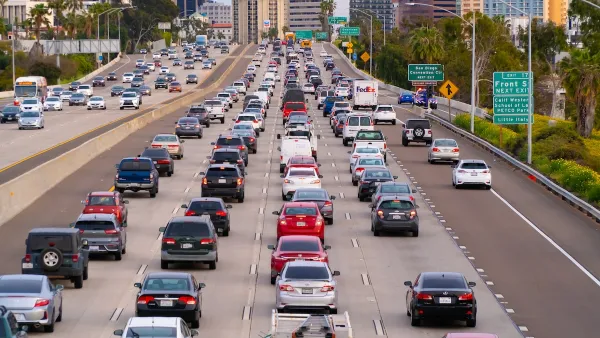
As many commentators have written, places with higher population density (more residents per acre or per square mile) tend to have higher levels of transit use and walking and less driving than lower-density areas. (For some examples of the relevant literature, see here, here, and here.)
One common counterargument is that this rule of thumb only applies to certain levels of density, and not to all neighborhoods. In car-dependent environments such as the suburban part of Atlanta where I grew up, an opponent of denser housing might argue that adding a few apartments or houses won't change the neighborhood's fundamentally car-dependent fabric. Therefore, dense development should be limited to the areas that are already walkable or have significant public transit ridership.
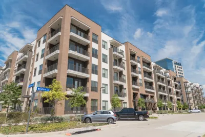
On the other hand, residents of dense areas such as my Manhattan neighborhood might argue (based on numerous graphs such as this one) that the sharpest reductions in vehicle miles traveled (VMT) occur at moderate-to-high levels of density (roughly 50-100 persons per acre) and that building housing at Manhattan levels of density does not reduce VMT.*
Is either claim true? The most precise data I have found on this subject was in a 1994 study by John Holtzclaw. Instead of relying on easily manipulated graphs, Holtzclaw's study supplies precise numbers that show how VMT changes as density and transit service rise. As I noted some years ago, Holtzclaw's study shows that even at the highest levels of density, there is always some benefit from additional housing: a shift from 100 households per acre to 500 households per acre reduces VMT.
But does that mean that a city gets the most bang for the buck by building at that level of density? Let's look at Table 7 of Holtzclaw's study. This table shows that in an area with five buses per hour, predicted VMT is 9,589 miles per household at 100 units per acre, 6,413 at 500, and 5,116 at 1,000.* Those reductions seem pretty significant to me, so if Holtzclaw's numbers are correct, it is not true that the benefits of density disappear at the highest density levels.
On the other hand, the biggest gains seem to come at very low density levels. In particular: an increase from two units per acre to three decreases VMT per household by over 2,000 miles, from 25,500 to 23,042. Thus, in this sprawling, low-density environment, one new housing unit per acre reduces VMT by over 2,000 miles, or 8 percent. An increase from two units per acre to five reduces VMT from 23,042 to 20,279. That means this increase reduces VMT by 2,763, or 1,381.5 per housing unit, or 6 percent, a somewhat lower reduction.
As density increases, VMT reductions per unit continue to decline. An increase from 5 units per acre to 10 reduces VMT from 20,279 to 17,053, or 3,226. At this level of density, new housing reduces VMT by only 645 miles per housing unit, or 3 percent. An increase from 10 units per acre to 20 reduces VMT from 17,053 miles per housing unit to 14,340, or 2,613. This means that this doubling of housing reduces VMT by 261 miles per housing unit, or about 1.5 percent. An increase from 20 units to 30 reduces VMT still further from 14,340 to 12,957, or 1,383. VMT is reduced by 138 miles per housing unit at this density, or 0.9 percent. An increase from 30 units per acre to 50 reduces VMT from 12,957 to 11,404, a total VMT reduction of 1,553—that is, only 77 miles per housing unit, or 0.6 percent. An increase from 50 units to 100 reduces VMT from 11,404 per household to 9,589 for a VMT reduction of 1,815, or 36 per housing unit. An increase from 100 units per acre to 500 units per acre reduces VMT from 9,589 to 6,413. This might sound impressive, but at this level of density each housing unit reduces VMT by only 8 miles.
So what's my point? My point is that the level of diminishing returns doesn't begin at 30 or 50 or 100 miles per acre. In fact, if Holtzclaw's model is accurate, the greatest VMT reductions are at the lowest levels of density, when a car-dependent, two-houses-per-acre neighborhood becomes a car-dependent, three-house-per-acre neighborhood. But having said that, there is no point where increased density absolutely fails to reduce VMT. Even an area with 1,000 units per acre, as noted above, has lower VMT than 500 units per acre.
So what are the policy implications of this? First, additional density in the middle of car-dependent sprawl might reduce VMT significantly, even if it does not affect the number of motorists at all. Thus, there is a legitimate environmental argument for infill development even if it is not significant enough to make an area more walkable or transit-friendly.
Second, development in high-density places also reduces VMT to some extent, even if the additional increment of VMT reduction is lower than the additional increment of VMT reduction per house in a sprawling area. And if lots of houses or apartments are added at a time, the VMT reductions can become more significant even at high levels of density.
I also note that even if I was wrong about the latter point (i.e., if VMT per household was the same at 50 units per acre as at 100-500 units per acre) there might be strong environmental argument for increasing density in already dense areas. Here's why: imagine a walkable urban neighborhood with 1000 people and 50 units per acre. A developer proposes to a zoning change to add enough buildings for 200 new residents; the upzoning would raise neighborhood density to 60 units per acre. If the housing is built, 1,200 people live in a 60-unit-per-acre neighborhood. But if the housing is not built, what happens to the 200 persons who would otherwise live there? If they move to other, equally dense neighborhoods, VMT does not change very much. But if they move to a low-density suburb with four units per acre (or displace people who do), now you have 1,000 people who still get to live in their 50 units per acre neighborhood, but 200 who have to settle for four units per acre. If the latter scenario happens, the 200 displaced residents would drive more than they otherwise would, and VMT would increase.
*If you want to know what various levels of density look like in reality, this post on “visualizing density” and this museum exhibit on Manhattan density might be useful. To briefly summarize: I'm not sure there has ever been a place in the U.S. that has had 1000 households per acre, because the most dense environment listed in the exhibit has 1100 persons per acre (which, assuming 2 or 3 people per household, equals 500 or fewer households per acre). There are parts of Manhattan which might have 500 households per acre; however, densities of 50-150 units per acre are more common in urban America.

Opinion: Why Linking Driving to GDP Misses the Point
The argument that car-centric development is good because it boosts national GDP ignores the massive costs of driving to everyday Americans.

Commentary: We Need a Return to the Adaptability of Traditional Urban Form
How the rigidity of modern suburban development fails to prepare cities for the future.

Commentary: A New ‘Grand Bargain’ for American Housing
For decades, many U,S, neighborhoods successfully resisted change at the expense of a few neighborhoods sacrificed to mass development. Is there a better way?

National Parks Layoffs Will Cause Communities to Lose Billions
Thousands of essential park workers were laid off this week, just before the busy spring break season.

Retro-silient?: America’s First “Eco-burb,” The Woodlands Turns 50
A master-planned community north of Houston offers lessons on green infrastructure and resilient design, but falls short of its founder’s lofty affordability and walkability goals.

Delivering for America Plan Will Downgrade Mail Service in at Least 49.5 Percent of Zip Codes
Republican and Democrat lawmakers criticize the plan for its disproportionate negative impact on rural communities.

Test News Post 1
This is a summary

Test News Headline 46
Test for the image on the front page.

Balancing Bombs and Butterflies: How the National Guard Protects a Rare Species
The National Guard at Fort Indiantown Gap uses GIS technology and land management strategies to balance military training with conservation efforts, ensuring the survival of the rare eastern regal fritillary butterfly.
Urban Design for Planners 1: Software Tools
This six-course series explores essential urban design concepts using open source software and equips planners with the tools they need to participate fully in the urban design process.
Planning for Universal Design
Learn the tools for implementing Universal Design in planning regulations.
EMC Planning Group, Inc.
Planetizen
Planetizen
Mpact (formerly Rail~Volution)
Great Falls Development Authority, Inc.
HUDs Office of Policy Development and Research
NYU Wagner Graduate School of Public Service