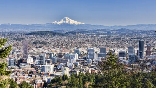
A documentary focusing on Portland's urban growth boundary begins airing this month on public television stations across the country. It includes interviews with proponents on all sides of the smart growth issue.
The documentary is a collaboration between Northern Light Productions and the Lincoln Institute of Land Policy. "Portland has been a notable experiment in land use planning, and the film shows how challenging that can be," said Gregory K. Ingram, president of the Lincoln Institute of Land Policy. "The issues that come to life in the film - property rights, the value of land, density and transportation, planning and citizen participation - include many that we think cities all over the U.S. will need to confront." Following the passage of Oregon's landmark land use planning system in 1973, Portland established an urban growth boundary containing development within a 22-square-mile area, protecting surrounding farmland and open space; a regional governance system spanning 24 municipalities and three counties; and an ambitious system of light rail and streetcars to service more dense, compact, mixed-use urban form. Then, in 2004, after a state-wide campaign that raised questions about property rights and the fairness of the entire regulatory framework, voters passed Measure 37, which allowed development outside the urban growth boundary. A competing initiative, Measure 49, was then put on the ballot in 2008 to reverse those changes.
Incorporating historic footage of Portland as the self-proclaimed "City that Works," and recent interviews with city leaders and neighborhood residents during the battles over ballot measures on the land-use planning system, Portland: Quest for the Livable City is a cautionary tale for planning in the 21st century. As cities across the country today attempt to reduce greenhouse gas emissions, invest in transit, and focus on infill redevelopment as an alternative to car-dependent sprawl, the experience of Portland underscores a complex web of issues including economic development and jobs, gentrification, local food and farming, property rights, and civic participation."
FULL STORY: Portland: Quest for the Livable City, a Documentary Film Chronicling Struggle for Sustainablity, Debuts

National Parks Layoffs Will Cause Communities to Lose Billions
Thousands of essential park workers were laid off this week, just before the busy spring break season.

Retro-silient?: America’s First “Eco-burb,” The Woodlands Turns 50
A master-planned community north of Houston offers lessons on green infrastructure and resilient design, but falls short of its founder’s lofty affordability and walkability goals.

Delivering for America Plan Will Downgrade Mail Service in at Least 49.5 Percent of Zip Codes
Republican and Democrat lawmakers criticize the plan for its disproportionate negative impact on rural communities.

Test News Post 1
This is a summary

Test News Headline 46
Test for the image on the front page.

Balancing Bombs and Butterflies: How the National Guard Protects a Rare Species
The National Guard at Fort Indiantown Gap uses GIS technology and land management strategies to balance military training with conservation efforts, ensuring the survival of the rare eastern regal fritillary butterfly.
Urban Design for Planners 1: Software Tools
This six-course series explores essential urban design concepts using open source software and equips planners with the tools they need to participate fully in the urban design process.
Planning for Universal Design
Learn the tools for implementing Universal Design in planning regulations.
EMC Planning Group, Inc.
Planetizen
Planetizen
Mpact (formerly Rail~Volution)
Great Falls Development Authority, Inc.
HUDs Office of Policy Development and Research
NYU Wagner Graduate School of Public Service


