


The NYC Transit Explorer from Sidewalk Labs shows how much transit service New Yorkers stand to lose when the L Train shuts down for 18 months.
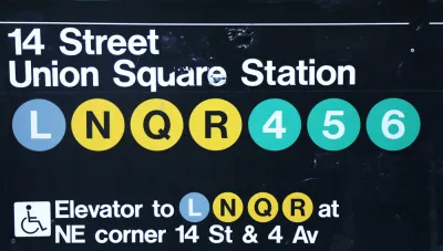
Dan Vanderkam writes a post to explain how Sidewalk Labs worked with the New York-based advocacy group Transportation Alternatives to create an interactive tool to illustrate how the looming shutdown of the L Train in New York will affect residents and commuters.
The tool is a map demo we’re calling the NYC Transit Explorer. It’s built on top of a transit router that uses the latest GTFS feeds for all MTA bus and subway lines, as well as the Staten Island ferry, to determine travel times and routes throughout the five boroughs. Traditional navigation routers direct people from Point A to Point B (call it one-to-one); our router adds the ability to show people how long it would take to get anywhere in the city via transit from a given origin (one-to-many).
After explaining the tool, Vanderkam then walks through step-by-step examples to show how the L Train closure will affect transit trips between Brooklyn and Manhattan—in terms of general accessibility and along specific routes. The post concludes with a call to action developers and civic hackers for help improving the tool.
FULL STORY: New map demo: How the L train shutdown will impact your commute

First Weekend of L Train Slowdown Could Have Been Worse
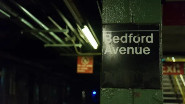
The long awaited repair work on the L Train between Brooklyn and Manhattan launched over the weekend.
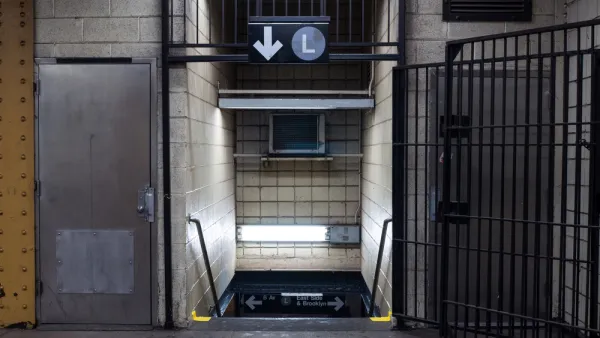
Breaking: Gov. Cuomo Cancels L Train Closure
Surprise, shocking news from New York City, as Governor Andrew Cuomo steps in at the 11th hour to change course on the highly anticipated (and dreaded) L Train closure scheduled to begin later this year.

Single-Occupant Vehicles Banned on Williamsburg Bridge During L Train Closure
Solo commuters crossing from Brooklyn to Manhattan on the Williamsburg Bridge are in for a rude awakening on April 27 when the L Train closes. To accommodate more buses and bikes on the 115-year old bridge, cars will need at least 3 people.

National Parks Layoffs Will Cause Communities to Lose Billions
Thousands of essential park workers were laid off this week, just before the busy spring break season.

Retro-silient?: America’s First “Eco-burb,” The Woodlands Turns 50
A master-planned community north of Houston offers lessons on green infrastructure and resilient design, but falls short of its founder’s lofty affordability and walkability goals.

Delivering for America Plan Will Downgrade Mail Service in at Least 49.5 Percent of Zip Codes
Republican and Democrat lawmakers criticize the plan for its disproportionate negative impact on rural communities.

Test News Post 1
This is a summary

Test News Headline 46
Test for the image on the front page.

Balancing Bombs and Butterflies: How the National Guard Protects a Rare Species
The National Guard at Fort Indiantown Gap uses GIS technology and land management strategies to balance military training with conservation efforts, ensuring the survival of the rare eastern regal fritillary butterfly.
Urban Design for Planners 1: Software Tools
This six-course series explores essential urban design concepts using open source software and equips planners with the tools they need to participate fully in the urban design process.
Planning for Universal Design
Learn the tools for implementing Universal Design in planning regulations.
EMC Planning Group, Inc.
Planetizen
Planetizen
Mpact (formerly Rail~Volution)
Great Falls Development Authority, Inc.
HUDs Office of Policy Development and Research
NYU Wagner Graduate School of Public Service