


The new INRIX Traffic Scorecard uses "big" data to calculate congestion costs. Like previous studies, it exaggerates traffic congestion costs and roadway expansion benefits.
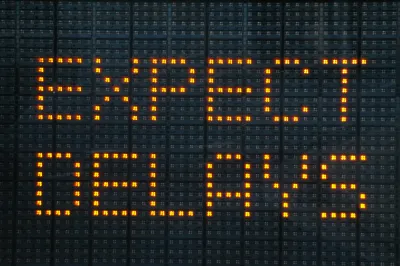
The newly released INRIX 2016 Traffic Scorecard uses cell phone, vehicle tracking and GPS data to calculate traffic speeds and congestion delays in U.S. cities. But critical analysis by City Observatory researcher Joe Cortright (Yet Another Flawed Congestion Report from Inrix: Big Data Provides Little Insight) challenges the Scorecard's methods and conclusions.
"One one level, its a truly impressive display of big data. Inrix has compiled 500 terabytes of data, for hundreds of thousands of roadway segments, from hundreds of millions of sources on more than a thousand cities around the globe. That’s a real wealth of information. Inrix casually slips in the factoid that average speeds on New York streets are 8.23 mph, versus 11.07 mph and 11.54 mph in L.A. and San Francisco respectively. But unfortunately, in this particular report, it has chosen to process, filter and present this data in a way that chiefly serves to generate heat, rather than shed any light on the nature, causes and solutions to urban traffic problems. If 'big data' and 'smart cities' are really going to amount to anything substantial, it has to be more than just generating high tech scare stories."
Cortright identifies four key problems with the Scorecard:
- Methodology: New and non-comparable, but not significantly different or better
- An unrealistic definition of congestion
- Exaggerating costs
- Ignoring distance, discounting accessibility
FULL STORY: Yet Another Flawed Congestion Report from Inrix. Big Data Provides Little Insight

How Not To Measure Traffic Congestion—Hold the Hyperbole, Please!
The new INRIX congestion costing report is another good example of bad analysis. We just want accurate information; hold the hyperbole, please.

No, Traffic Congestion Does Not Really Cost Every American $1,348 Annually
The INRIX Global Traffic Scorecard exaggerates congestion costs in order to enhance the value of its traffic monitoring services. A little skepticism is justified.

Could Boston Join Seattle in Proposing Congestion Pricing?
The compelling reason behind Boston's looking at congestion pricing is traffic congestion, unlike Seattle where it is being viewed as a major way to reduce greenhouse gas reductions and fund public transit.

National Parks Layoffs Will Cause Communities to Lose Billions
Thousands of essential park workers were laid off this week, just before the busy spring break season.

Retro-silient?: America’s First “Eco-burb,” The Woodlands Turns 50
A master-planned community north of Houston offers lessons on green infrastructure and resilient design, but falls short of its founder’s lofty affordability and walkability goals.

Delivering for America Plan Will Downgrade Mail Service in at Least 49.5 Percent of Zip Codes
Republican and Democrat lawmakers criticize the plan for its disproportionate negative impact on rural communities.

Test News Post 1
This is a summary

Test News Headline 46
Test for the image on the front page.

Balancing Bombs and Butterflies: How the National Guard Protects a Rare Species
The National Guard at Fort Indiantown Gap uses GIS technology and land management strategies to balance military training with conservation efforts, ensuring the survival of the rare eastern regal fritillary butterfly.
Urban Design for Planners 1: Software Tools
This six-course series explores essential urban design concepts using open source software and equips planners with the tools they need to participate fully in the urban design process.
Planning for Universal Design
Learn the tools for implementing Universal Design in planning regulations.
EMC Planning Group, Inc.
Planetizen
Planetizen
Mpact (formerly Rail~Volution)
Great Falls Development Authority, Inc.
HUDs Office of Policy Development and Research
NYU Wagner Graduate School of Public Service