


A new book sheds light on maps created by cartographers in the Soviet Union that dove into remarkable detail about buildings, transportation networks, and other infrastructure in cities across the United States and around the world.
In their new book, Red Atlas, authors John Davies and Alexander J. Kent looks at the breadth of data compiled by Soviet cartographers on not only strategic military sites but also residential neighborhoods, including notes on whether neighborhood streets featured street trees. Greg Miller of National Geographic writes that the data was collected by satellites and publicly available information, and in some cases was supplemented by on the ground reconnaissance.
The Soviets also mapped American cities in remarkable detail, including some military buildings that don’t appear on American-made maps of the same era. These maps include notes on the construction materials and load-bearing capacity of bridges—things that would be near-impossible to know without people on the ground.
Miller writes that it is unclear how the maps became public, as they were never declassified. However, since their release, they have been used by telecommunications and oil companies, as well as humanitarian groups and scientists working I nremote areas.
FULL STORY: The Soviet Military Program that Secretly Mapped the Entire World

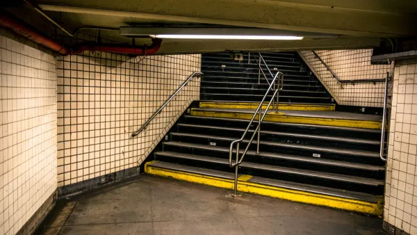
Subways as Shelters
Subways in Kyiv and Kharkiv are performing as bomb shelters, including the world's deepest station, after the full-scale Russian invasion of Ukraine began on Wednesday night.

Friday Funny: Cartographers Are Hiding an Idyllic Continent
The rest of the world would only spoil it for the mapmakers.

Friday Eye Candy: The Childhood Maps of 8 Professional Mapmakers
Choosing cartography as a career is a natural result of a lifelong love of maps. National Geographic gathers the proof.

Analysis: Cybertruck Fatality Rate Far Exceeds That of Ford Pinto
The Tesla Cybertruck was recalled seven times last year.

National Parks Layoffs Will Cause Communities to Lose Billions
Thousands of essential park workers were laid off this week, just before the busy spring break season.

Retro-silient?: America’s First “Eco-burb,” The Woodlands Turns 50
A master-planned community north of Houston offers lessons on green infrastructure and resilient design, but falls short of its founder’s lofty affordability and walkability goals.

Test News Post 1
This is a summary

Analysis: Cybertruck Fatality Rate Far Exceeds That of Ford Pinto
The Tesla Cybertruck was recalled seven times last year.

Test News Headline 46
Test for the image on the front page.
Urban Design for Planners 1: Software Tools
This six-course series explores essential urban design concepts using open source software and equips planners with the tools they need to participate fully in the urban design process.
Planning for Universal Design
Learn the tools for implementing Universal Design in planning regulations.
EMC Planning Group, Inc.
Planetizen
Planetizen
Mpact (formerly Rail~Volution)
Great Falls Development Authority, Inc.
HUDs Office of Policy Development and Research
NYU Wagner Graduate School of Public Service