


Navigation apps like Waze often reroute drivers onto residential streets that would be quiet otherwise. With some residents unable to leave their driveways, the New Jersey borough of Leonia has taken an extreme measure against the problem.
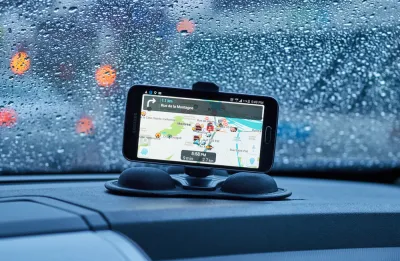
It's a case of algorithms versus angry residents. Lisa W. Foderaro writes, "With services like Google Maps, Waze and Apple Maps suggesting shortcuts for commuters through the narrow, hilly streets of Leonia, N.J., the borough has decided to fight back against congestion that its leaders say has reached crisis proportions."
The battle plan is simple: keep all of the out-of-towners out. "In mid-January, the borough's police force will close 60 streets to all drivers aside from residents and people employed in the borough during the morning and afternoon rush periods, effectively taking most of the town out of circulation for the popular traffic apps — and for everyone else, for that matter."
Borough officials claim this is legal, but it may invite challenge. "Some traffic engineers and elected officials elsewhere say the move may set a precedent that could encourage towns to summarily restrict public access to outsiders."
Meanwhile, many Leonia residents are happy they won't have to convince an endless stream of motorists to let them leave their driveways in the morning.
FULL STORY: Navigation Apps Are Turning Quiet Neighborhoods Into Traffic Nightmares


Waze vs. Residential Neighborhoods
Accounts of disgruntled residents responding by any means necessary to the flood of cars beckoned by the whims of navigation apps like Waze are spreading across the country.
Are Traffic Apps More a Problem Than a Solution?
The companies behind navigation apps say they want to decrease congestion in cities. But a tool that is essentially designed to help individuals isn’t going to provide a collective benefit.

Google Maps for iPhone Now Reports DUI Checkpoints, Speed Traps
Navigation app Waze has long allowed users the ability to report various "inconveniences" on the road, like speed traps, checkpoints, and crashes. Now Google Maps users on iPhone can do the same.

National Parks Layoffs Will Cause Communities to Lose Billions
Thousands of essential park workers were laid off this week, just before the busy spring break season.

Retro-silient?: America’s First “Eco-burb,” The Woodlands Turns 50
A master-planned community north of Houston offers lessons on green infrastructure and resilient design, but falls short of its founder’s lofty affordability and walkability goals.

Delivering for America Plan Will Downgrade Mail Service in at Least 49.5 Percent of Zip Codes
Republican and Democrat lawmakers criticize the plan for its disproportionate negative impact on rural communities.

Test News Post 1
This is a summary

Test News Headline 46
Test for the image on the front page.

Balancing Bombs and Butterflies: How the National Guard Protects a Rare Species
The National Guard at Fort Indiantown Gap uses GIS technology and land management strategies to balance military training with conservation efforts, ensuring the survival of the rare eastern regal fritillary butterfly.
Urban Design for Planners 1: Software Tools
This six-course series explores essential urban design concepts using open source software and equips planners with the tools they need to participate fully in the urban design process.
Planning for Universal Design
Learn the tools for implementing Universal Design in planning regulations.
EMC Planning Group, Inc.
Planetizen
Planetizen
Mpact (formerly Rail~Volution)
Great Falls Development Authority, Inc.
HUDs Office of Policy Development and Research
NYU Wagner Graduate School of Public Service