


To ensure funding for the LBJ East, Texas Transportation Commission officials might take three other major highway projects off the table.
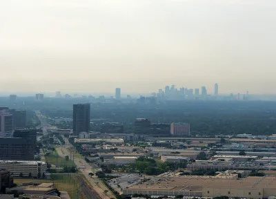
"The anger and frustration of motorists stuck on LBJ Freeway may soon spread to users of a trio of other crowded North Texas roadways," reports Ray Lesczynski.
That's because "[f]unds to improve three highway logjams are being used as collateral to persuade the Texas Transportation Commission to build LBJ East, the 10.8 miles of Interstate 635 between Interstate 30 and Central Expressway that has been deemed the region's top transportation project."
The three projects being leveraged for the sake of the LBJ East: a bridge over Lake Ray Hubbard on Interstate 30, Interstate 35E between LBJ and the Denton County line, and U.S. Highway 80 east toward Kaufman County.
The article includes soundbites from politicians backing each of the projects, and the land use and development context driving the case for each project. "Most North Texas county officials don't dispute the need for LBJ East or the project's status as the region's top priority," explains Lesczynski. "But they resent state leaders for taking North Texas' funding solution — two tolled (managed) lanes in each direction — off the table."
FULL STORY: With $2.5 billion in backed-up highway projects, North Texans turn up the heat on Austin

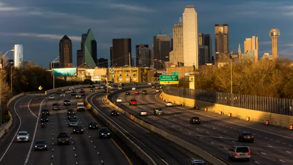
The City of Dallas Rejects the State of Texas on Plans to Widen Interstate 30
A plan to widen the Interstate 30 in Dallas is pitting state transportation officials, with ostensible goals to serve regional transportation needs, against local officials, who are more concerned with "neighborhood-centric ideals."
North Texas Transportation Council Advocates for Road Safety, Rail Projects
The North Texas Regional Transportation Council issued a series of recommendations for state legislators that include more support for road safety projects and high-speed rail.
$10 Billion Approved for Highway Funding in Washington State
Despite the drastic funding limitation imposed by Washington's voter-approved Initiative 976, the state found a way to fund $10.4 billion in (mostly highway) transportation projects.
National Parks Layoffs Will Cause Communities to Lose Billions
Thousands of essential park workers were laid off this week, just before the busy spring break season.

Retro-silient?: America’s First “Eco-burb,” The Woodlands Turns 50
A master-planned community north of Houston offers lessons on green infrastructure and resilient design, but falls short of its founder’s lofty affordability and walkability goals.

Delivering for America Plan Will Downgrade Mail Service in at Least 49.5 Percent of Zip Codes
Republican and Democrat lawmakers criticize the plan for its disproportionate negative impact on rural communities.

Test News Post 1
This is a summary

Test News Headline 46
Test for the image on the front page.

Balancing Bombs and Butterflies: How the National Guard Protects a Rare Species
The National Guard at Fort Indiantown Gap uses GIS technology and land management strategies to balance military training with conservation efforts, ensuring the survival of the rare eastern regal fritillary butterfly.
Urban Design for Planners 1: Software Tools
This six-course series explores essential urban design concepts using open source software and equips planners with the tools they need to participate fully in the urban design process.
Planning for Universal Design
Learn the tools for implementing Universal Design in planning regulations.
EMC Planning Group, Inc.
Planetizen
Planetizen
Mpact (formerly Rail~Volution)
Great Falls Development Authority, Inc.
HUDs Office of Policy Development and Research
NYU Wagner Graduate School of Public Service