


More uses and modes than ever are fighting for curb space in growing cities. Here's an app to make sense of what you can do, and when, along this valued real estate.

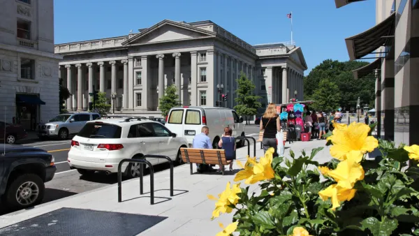
Andrew J. Hawkins shares news of a new tool released by Sidewalk Labs recently that makes visual sense of the way cities allow access to curb space lining busy streets.
According to Hawkins, "with the explosion of new mobility options like ride-hailing, car-sharing, and bike-sharing, and the looming specter of self-driving vehicles on the horizon, cities are starting to rethink how they allocate curb space."
Sidewalk Labs response to these changing dynamics is called Coord, a new company "focused on helping cities and mobility companies better manage traffic congestion and parking problems on their streets through a cloud-based platform."
"After digitizing the city’s curbs, including parking meters, parking signs, and curb stripes, Coord condensed all that data into a map that’s searchable by date, time, vehicle type, and desired action," adds Hawkins.
Coord released a map of San Francisco's curbsides to demonstrate the power of the idea. Hawkins outlines some use cases and previews the new mapping tool at the source article.
FULL STORY: Become a parking savant with Sidewalk Labs’ new curb visualization tool


How the Pandemic Is Reshaping Cities
The social and economic upheaval of the last two years accelerated a shift in thinking about how we use public space and organize the urban realm.

Pilot Projects Launched to Test Coordinated Curb Use
Coord, a Sidewalk Labs spinoff, has selected the winners of the inaugural Digital Curb Challenge.
Next on the List for Data Startups: Managing Curb Space
The humble curb is getting crowded: not only with new modes of transportation, but also with a slew of new data tools aiming to keep track of it all.

National Parks Layoffs Will Cause Communities to Lose Billions
Thousands of essential park workers were laid off this week, just before the busy spring break season.

Retro-silient?: America’s First “Eco-burb,” The Woodlands Turns 50
A master-planned community north of Houston offers lessons on green infrastructure and resilient design, but falls short of its founder’s lofty affordability and walkability goals.

Delivering for America Plan Will Downgrade Mail Service in at Least 49.5 Percent of Zip Codes
Republican and Democrat lawmakers criticize the plan for its disproportionate negative impact on rural communities.

Test News Post 1
This is a summary

Test News Headline 46
Test for the image on the front page.

Balancing Bombs and Butterflies: How the National Guard Protects a Rare Species
The National Guard at Fort Indiantown Gap uses GIS technology and land management strategies to balance military training with conservation efforts, ensuring the survival of the rare eastern regal fritillary butterfly.
Urban Design for Planners 1: Software Tools
This six-course series explores essential urban design concepts using open source software and equips planners with the tools they need to participate fully in the urban design process.
Planning for Universal Design
Learn the tools for implementing Universal Design in planning regulations.
EMC Planning Group, Inc.
Planetizen
Planetizen
Mpact (formerly Rail~Volution)
Great Falls Development Authority, Inc.
HUDs Office of Policy Development and Research
NYU Wagner Graduate School of Public Service