


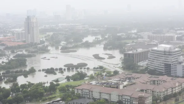
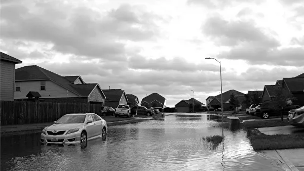
The most recent post-Harvey proposal would mean the city could endure enormous rain events, but so far it's not clear who would pay for it.
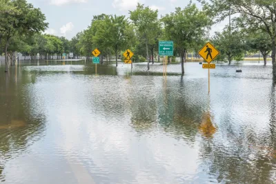
Nearly seven months after Hurricane Harvey spilled 50 inches of water onto the Gulf Coast of Texas, the Harris County Flood Control District has proposed building "massive, underground tunnels to carry flood waters from several Houston-area bayous toward the Houston Ship Channel."
Houston was plagued by flooding long before Harvey, so this multi-billion-dollar project would be in addition to plans to make the bayous more flood-proof that were in the works long before Harvey, and which have been expedited in the wake of the storm.
Those projects have all been partnerships between the HCFCD and the U.S. Army Corps of Engineers; so far it's not clear who would pay for the new tunnel project, but director of operations tells the Houston Chronicle "the district hopes to work with the Federal Emergency Management Agency and the state to possibly help pay for it."
Houston has given a great deal of consideration to flood control since the biggest flooding event in its history; the city is redrawing the flood maps, rethinking flood insurance, and considering more green infrastructure to manage stormwater in the future.
FULL STORY: Flood control district exploring plan to build massive tunnels to carry away stormwater


Harris County Will Use Toll Road Revenue to Pay for Flood Control
A new Flood Resilience Trust will create a permanent source of funding for flood control purposes, but the county still faces a shortfall for planned projects.
Houston Seriously Tightens Rules on Floodplain Construction
It was the city's "first major regulatory response" to Hurricane Harvey.
After Harvey, Texas Tries State-Run Disaster Relief, With Mixed Results
The scale of the housing recovery effort means some jobs normally handles by FEMA have fallen to the Texas General Land Office.

National Parks Layoffs Will Cause Communities to Lose Billions
Thousands of essential park workers were laid off this week, just before the busy spring break season.

Retro-silient?: America’s First “Eco-burb,” The Woodlands Turns 50
A master-planned community north of Houston offers lessons on green infrastructure and resilient design, but falls short of its founder’s lofty affordability and walkability goals.

Delivering for America Plan Will Downgrade Mail Service in at Least 49.5 Percent of Zip Codes
Republican and Democrat lawmakers criticize the plan for its disproportionate negative impact on rural communities.

Test News Post 1
This is a summary

Test News Headline 46
Test for the image on the front page.

Balancing Bombs and Butterflies: How the National Guard Protects a Rare Species
The National Guard at Fort Indiantown Gap uses GIS technology and land management strategies to balance military training with conservation efforts, ensuring the survival of the rare eastern regal fritillary butterfly.
Urban Design for Planners 1: Software Tools
This six-course series explores essential urban design concepts using open source software and equips planners with the tools they need to participate fully in the urban design process.
Planning for Universal Design
Learn the tools for implementing Universal Design in planning regulations.
EMC Planning Group, Inc.
Planetizen
Planetizen
Mpact (formerly Rail~Volution)
Great Falls Development Authority, Inc.
HUDs Office of Policy Development and Research
NYU Wagner Graduate School of Public Service