


A comprehensive study to revitalize the Atlanta regional waterfront, dubbed the Chattahoochee RiverLands project, is now underway.
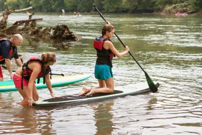
A joint planning effort by the city of Atlanta, Cobb County, the Atlanta Regional Commission (ARC), and the Trust for Public Land (TPL) is exploring ways to make the land along the Chattahoochee River more livable, workable, and playable for Atlanta and beyond. In SaportaReport, Walt Ray with TPL and Byron Rushing with ARC detail the intentions guiding the process.
The $1.5 million study deals with the length of the river from Buford Dam to Chattahoochee Bend State Park. That 100-mile stretch, divided among many jurisdictions, includes: city and county parks, state conservation lands, federal property, a sundry mix of trail authorities, and more. It's also governed by a variety of planning frameworks, including ARC's 2016 regional trails plan, Cobb County's 2017 trails plan, and Tim Keane's Atlanta City Design, adopted by the city in 2017.
The aim of the RiverLands project is to stitch all of those elements together to create what Rushing calls "a seamless public realm along the Chattahoochee River." One goal is to connect existing and new trails to the Silver Comet Trail, suburban communities, and MARTA stations. Others include driving economic development, restoring ecological habitat, and increasing public access to open green space.
FULL STORY: The Future Begins Now: An Update on the Chattahoochee River Master Planning Process

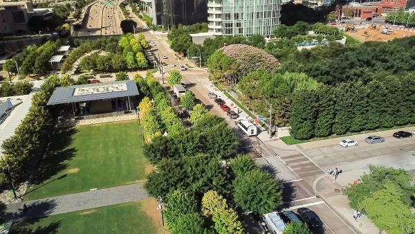
Riverfront Trail Takes Shape in Atlanta
Open space and mixed-use developments could make the Chattahoochee River, where it runs along the border of Atlanta, more accessible. A proposed trail along the river took a tangible step forward recently.

Parks as Community Lifelines: Supporting Residents During Times of Crisis
The Los Angeles County Department of Parks and Recreation demonstrates how parks serve as vital community infrastructure by adapting to crises, offering public health services, disaster relief, and essential support for residents in need.
I Help Plan Cap Parks; Here’s What Austin Can Learn from Other Cities
How freeway capping projects can literally and metaphorically bridge urban divides.

National Parks Layoffs Will Cause Communities to Lose Billions
Thousands of essential park workers were laid off this week, just before the busy spring break season.

Retro-silient?: America’s First “Eco-burb,” The Woodlands Turns 50
A master-planned community north of Houston offers lessons on green infrastructure and resilient design, but falls short of its founder’s lofty affordability and walkability goals.

Delivering for America Plan Will Downgrade Mail Service in at Least 49.5 Percent of Zip Codes
Republican and Democrat lawmakers criticize the plan for its disproportionate negative impact on rural communities.

Test News Post 1
This is a summary

Test News Headline 46
Test for the image on the front page.

Balancing Bombs and Butterflies: How the National Guard Protects a Rare Species
The National Guard at Fort Indiantown Gap uses GIS technology and land management strategies to balance military training with conservation efforts, ensuring the survival of the rare eastern regal fritillary butterfly.
Urban Design for Planners 1: Software Tools
This six-course series explores essential urban design concepts using open source software and equips planners with the tools they need to participate fully in the urban design process.
Planning for Universal Design
Learn the tools for implementing Universal Design in planning regulations.
EMC Planning Group, Inc.
Planetizen
Planetizen
Mpact (formerly Rail~Volution)
Great Falls Development Authority, Inc.
HUDs Office of Policy Development and Research
NYU Wagner Graduate School of Public Service