


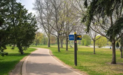
Linking up the last part of the Grand Rounds trail would create a continuous pedestrian and biking loop around the city.
.jpg)
A newly proposed master plan for Minneapolis includes details for a five-mile link that would close the gap in the city’s Grand Rounds trail, reports Jessica Lee. If the last leg is completed, the route would extend the now 50-mile trail and provide a continuous loop around the city.
Lee says that city officials by 2009 had made five unsuccessful attempts to build the extension. This latest effort is part of the East of the River Park Master Plan and would connect trails in the southeast and northeast of the city.
Stakeholders generally agree about what should happen on the north and south ends of the proposed extension. The middle section, however, would include land owned by the University of Minnesota, which is not fully on board with the plan. The route would also traverse a BNSF Railway rail yard and require the construction of bridges, a costly prospect, notes Lee.
The city’s park and recreation board will vote on the master plan in February. If approved, it will continue on to the Metropolitan Council, the Minneapolis regional planning organization, which oversees funding for the trail.
FULL STORY: Momentum building to fill in Grand Rounds’ missing link

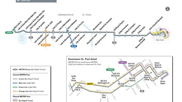
New Bus Rapid Transit Route Breaks Ground in the Twin Cities
The Twin Cities are on a mission to become the bus rapid transit capital of the United States. The latest improvement to advance that ambition broke ground earlier this week.

Minneapolis LRT Facing Delays, Cost Increases
Construction on the Kenilworth Tunnel has been plagued by problems and threatens the foundation of a nearby condo complex.

Twin Cities Climate Vulnerability: Extreme Heat
State climatologists are highly confident that heat waves are likely to trend upwards in future summers in Minnesota. To address extreme heat, researchers are identifying the factors that exacerbate extreme heat.

National Parks Layoffs Will Cause Communities to Lose Billions
Thousands of essential park workers were laid off this week, just before the busy spring break season.

Retro-silient?: America’s First “Eco-burb,” The Woodlands Turns 50
A master-planned community north of Houston offers lessons on green infrastructure and resilient design, but falls short of its founder’s lofty affordability and walkability goals.

Delivering for America Plan Will Downgrade Mail Service in at Least 49.5 Percent of Zip Codes
Republican and Democrat lawmakers criticize the plan for its disproportionate negative impact on rural communities.

Test News Post 1
This is a summary

Test News Headline 46
Test for the image on the front page.

Balancing Bombs and Butterflies: How the National Guard Protects a Rare Species
The National Guard at Fort Indiantown Gap uses GIS technology and land management strategies to balance military training with conservation efforts, ensuring the survival of the rare eastern regal fritillary butterfly.
Urban Design for Planners 1: Software Tools
This six-course series explores essential urban design concepts using open source software and equips planners with the tools they need to participate fully in the urban design process.
Planning for Universal Design
Learn the tools for implementing Universal Design in planning regulations.
EMC Planning Group, Inc.
Planetizen
Planetizen
Mpact (formerly Rail~Volution)
Great Falls Development Authority, Inc.
HUDs Office of Policy Development and Research
NYU Wagner Graduate School of Public Service