


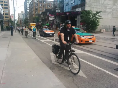
A pilot project of cycle tracks on several streets in Toronto produced almost shockingly positive results for all users of the street. At very little cost, the new bike infrastructure increased total street capacity and improved safety.
A report by the city of Toronto to evaluate the performance of cycle tracks on Richmond Street and Adelaide Street, as well as north-south cycle tracks on Simcoe Street and Peter Street, recommends converting the temporary installations to permanent infrastructure facilities.
The report "tells a commuting story of roaring success that was accomplished with little fanfare and even less cost," according to an article by Edward Keenan. According to the report, 730 people biked on Richmond and Adelaide streets before the temporary cycle tracks were installed in 2014. In 2018, that number had increased to 7,509 people biking on the streets every day.
"The city also monitored bike traffic on nearby streets to see if the change was a result of people taking the new lanes instead of travelling on King or Queen Sts," adds Keenan. "It found the decreases in cycle traffic on those roads was minimal, 'suggesting that 94 per cent of the growth in the number of cyclists on Richmond-Adelaide was as a result of new cyclists, shifting their transportation choice from another mode.'"
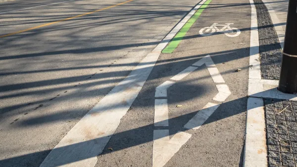
One final piece of smashing success to note here: "In the downtown core area, the bike lanes now carry almost a third of the vehicles travelling the road during the peak of rush hour, 'a higher volume of vehicles per lane than the motor vehicle lanes.'"
Additional data on improved safety and a lack of impact on trip times for cars are included in the article.
FULL STORY: Bike lanes prove that transportation solutions can be cheap and effective

A Troubling Trend of Backlash to Bike Lanes
Some cities are going so far as to rip out protected bike infrastructure that took years of advocacy to build.
Austin Outlaws Blocking Bike Lanes
Drivers who park in bike lanes will receive citations of up to $300.

Cleveland To Build First Protected Downtown Bike Lane
The city is taking steps to build out a more comprehensive bike lane network to connect downtown destinations.

National Parks Layoffs Will Cause Communities to Lose Billions
Thousands of essential park workers were laid off this week, just before the busy spring break season.

Retro-silient?: America’s First “Eco-burb,” The Woodlands Turns 50
A master-planned community north of Houston offers lessons on green infrastructure and resilient design, but falls short of its founder’s lofty affordability and walkability goals.

Delivering for America Plan Will Downgrade Mail Service in at Least 49.5 Percent of Zip Codes
Republican and Democrat lawmakers criticize the plan for its disproportionate negative impact on rural communities.

Test News Post 1
This is a summary

Test News Headline 46
Test for the image on the front page.

Balancing Bombs and Butterflies: How the National Guard Protects a Rare Species
The National Guard at Fort Indiantown Gap uses GIS technology and land management strategies to balance military training with conservation efforts, ensuring the survival of the rare eastern regal fritillary butterfly.
Urban Design for Planners 1: Software Tools
This six-course series explores essential urban design concepts using open source software and equips planners with the tools they need to participate fully in the urban design process.
Planning for Universal Design
Learn the tools for implementing Universal Design in planning regulations.
EMC Planning Group, Inc.
Planetizen
Planetizen
Mpact (formerly Rail~Volution)
Great Falls Development Authority, Inc.
HUDs Office of Policy Development and Research
NYU Wagner Graduate School of Public Service