


A survey of land use policies in cities and counties of California is designed to inform a more complete understanding of the housing market, sustainability, and economic mobility in the state.

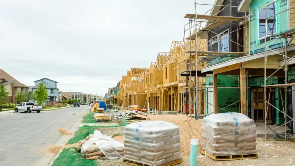
"The Terner Center for Housing Innovation at UC Berkeley has published the California Land Use Data Set, a comprehensive survey which looks at policies that affect the production, location, and preservation of housing in the state at the jurisdiction-level," according to an announcement from the University of California, Berkeley College of Environmental Design.
The survey collected data from August 2017 to October 2018, working in partnership with the California Department of Housing and Community Development. "The data set includes survey responses from 252 cities and 19 unincorporated county areas, and touches on issues from how land is zoned for different uses to the process a project goes through to get approved to policies aimed at producing affordable housing."
The survey "considers the effects of local land use policy on the supply of housing in a region, as well as its effects on sustainability, economic mobility, and access to neighborhoods and opportunity," according to the announcement. "It will help citizens and policy makers alike understand how cities in California are approaching the use of their land, and with what effect on the quantity, accessibility, and affordability of their housing."
The survey results are supplemented by a report [pdf] that provides several frames for understanding the results of the survey.
FULL STORY: TERNER CENTER PUBLISHES CALIFORNIA LAND USE DATA SET


The Link Between Transit Access and Employment
Inadequate access to transportation hinders many Americans’ access to job opportunities.

The Right to Mobility
As we consider how to decarbonize transportation, preserving mobility, especially for lower- and middle-income people, must be a priority.
The Housing Affordability Recipe
Smart policies can ensure that low- and moderate-income households can find suitable housing in good neighborhoods where transportation costs are low. The research is clear: upzoning works.

National Parks Layoffs Will Cause Communities to Lose Billions
Thousands of essential park workers were laid off this week, just before the busy spring break season.

Retro-silient?: America’s First “Eco-burb,” The Woodlands Turns 50
A master-planned community north of Houston offers lessons on green infrastructure and resilient design, but falls short of its founder’s lofty affordability and walkability goals.

Delivering for America Plan Will Downgrade Mail Service in at Least 49.5 Percent of Zip Codes
Republican and Democrat lawmakers criticize the plan for its disproportionate negative impact on rural communities.

Test News Post 1
This is a summary

Test News Headline 46
Test for the image on the front page.

Balancing Bombs and Butterflies: How the National Guard Protects a Rare Species
The National Guard at Fort Indiantown Gap uses GIS technology and land management strategies to balance military training with conservation efforts, ensuring the survival of the rare eastern regal fritillary butterfly.
Urban Design for Planners 1: Software Tools
This six-course series explores essential urban design concepts using open source software and equips planners with the tools they need to participate fully in the urban design process.
Planning for Universal Design
Learn the tools for implementing Universal Design in planning regulations.
EMC Planning Group, Inc.
Planetizen
Planetizen
Mpact (formerly Rail~Volution)
Great Falls Development Authority, Inc.
HUDs Office of Policy Development and Research
NYU Wagner Graduate School of Public Service