


The tech is part of a public-private partnership meant to improve connectivity to Waze and other navigation apps from underground.
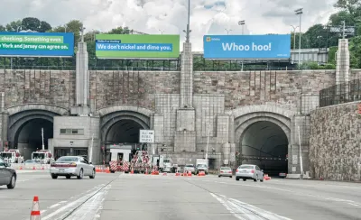
Waze has entered a partnership with the New York MTA and Port Authority aimed at improving navigation for drivers in New York City.
Several tunnels in the city now boast Waze Beacons, an open-source technology meant to allow users of navigation apps to stay connected even when they don't have a signal—particularly useful for drivers entering tunnels, the company expects. The tiny devices stick to tunnel walls and can support any navigation app, not just Waze. Chaim Gartenberg explains in The Verge:
"The Waze Beacons themselves are just battery-powered microcontrollers that use low-powered Bluetooth signals to communicate with smartphones, allowing for Waze to provide alternative location services to drivers even when out of GPS range (relying on Google’s near-field Eddystone technology to communicate)."
Boston, Chicago, and Pittsburgh are among the cities already using the private infrastructure, now also online in New York's Holland, Lincoln, Queens-Midtown, and Brooklyn-Battery Tunnels.
FULL STORY: Waze adds Beacons to NYC tunnels so drivers can stay connected to GPS apps

New York MTA Upholds Pause on Congestion Pricing, Scales Back Projects
The agency will not be able to go forward with former plans to improve station facilities and transit safety, and expand service.
New York MTA Makes Five Bus Routes Fare-Free
The state-funded effort is a way to assess how free fares impact ridership.
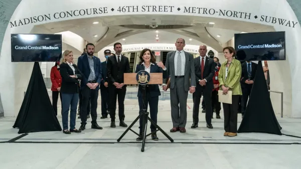
Long Island Rail Now Connects to Grand Central Terminal
A new rail service launched this week could save commuters as much as 40 minutes on trips between Long Island and Manhattan.

National Parks Layoffs Will Cause Communities to Lose Billions
Thousands of essential park workers were laid off this week, just before the busy spring break season.

Retro-silient?: America’s First “Eco-burb,” The Woodlands Turns 50
A master-planned community north of Houston offers lessons on green infrastructure and resilient design, but falls short of its founder’s lofty affordability and walkability goals.

Delivering for America Plan Will Downgrade Mail Service in at Least 49.5 Percent of Zip Codes
Republican and Democrat lawmakers criticize the plan for its disproportionate negative impact on rural communities.

Test News Post 1
This is a summary

Test News Headline 46
Test for the image on the front page.

Balancing Bombs and Butterflies: How the National Guard Protects a Rare Species
The National Guard at Fort Indiantown Gap uses GIS technology and land management strategies to balance military training with conservation efforts, ensuring the survival of the rare eastern regal fritillary butterfly.
Urban Design for Planners 1: Software Tools
This six-course series explores essential urban design concepts using open source software and equips planners with the tools they need to participate fully in the urban design process.
Planning for Universal Design
Learn the tools for implementing Universal Design in planning regulations.
EMC Planning Group, Inc.
Planetizen
Planetizen
Mpact (formerly Rail~Volution)
Great Falls Development Authority, Inc.
HUDs Office of Policy Development and Research
NYU Wagner Graduate School of Public Service