


The new linear park will use land under the city’s elevated rail tracks. Worries, however, are emerging about the effects the project will have on surrounding communities, particularly related to affordable housing.

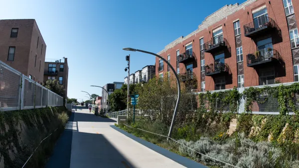
Adina Solomon reports on the Underline, a new 10-mile linear park project under the Miami Metrorail tracks, which broke ground in November last year and will provide bike and walking trails, open spaces, and other public and art spaces. The first phase of construction, a half-mile stretch in downtown Miami, is underway.
The Underline is facing concerns about gentrification and housing affordability — issues that have challenged similar projects such as the High Line in New York and the Atlanta BeltLine. "Friends of the Underline is about to embark on a study looking at neighborhood connectivity, accessibility and equitable growth, which will also explore a component for workforce and affordable housing," says Solomon.
The Underline’s leadership also plans to hold community meetings as the project continues. In addition, the organization is working with the High Line Network, a group of infrastructure reuse projects using an equitable impact framework.
FULL STORY: Who Will Benefit from Miami’s New Rails-to-Trails Park?

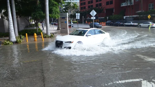
Climate Gentrification in Miami
With the threat of sea level rise, homes on higher ground in Miami are becoming increasingly desirable. But they are located in low-income communities of color, and residents are facing rising housing costs and displacement.

'Climate Gentrification' Is Exacerbating Economic Inequality in Miami
A new study shows that over the last several decades the price of real estate has been heavily influenced by the actual and anticipated effects of climate change.
Sustainable for Whom? Large-Scale Urban Development Projects and 'Environmental Gentrification'
Large, adaptive-reuse projects are all the rage in urban planning today, but absent a fundamentally new approach—with affordability at the center of the process—they are likely to become engines of what's been termed "environmental gentrification."

National Parks Layoffs Will Cause Communities to Lose Billions
Thousands of essential park workers were laid off this week, just before the busy spring break season.

Retro-silient?: America’s First “Eco-burb,” The Woodlands Turns 50
A master-planned community north of Houston offers lessons on green infrastructure and resilient design, but falls short of its founder’s lofty affordability and walkability goals.

Delivering for America Plan Will Downgrade Mail Service in at Least 49.5 Percent of Zip Codes
Republican and Democrat lawmakers criticize the plan for its disproportionate negative impact on rural communities.

Test News Post 1
This is a summary

Test News Headline 46
Test for the image on the front page.

Balancing Bombs and Butterflies: How the National Guard Protects a Rare Species
The National Guard at Fort Indiantown Gap uses GIS technology and land management strategies to balance military training with conservation efforts, ensuring the survival of the rare eastern regal fritillary butterfly.
Urban Design for Planners 1: Software Tools
This six-course series explores essential urban design concepts using open source software and equips planners with the tools they need to participate fully in the urban design process.
Planning for Universal Design
Learn the tools for implementing Universal Design in planning regulations.
EMC Planning Group, Inc.
Planetizen
Planetizen
Mpact (formerly Rail~Volution)
Great Falls Development Authority, Inc.
HUDs Office of Policy Development and Research
NYU Wagner Graduate School of Public Service