


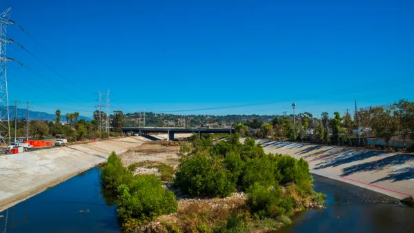
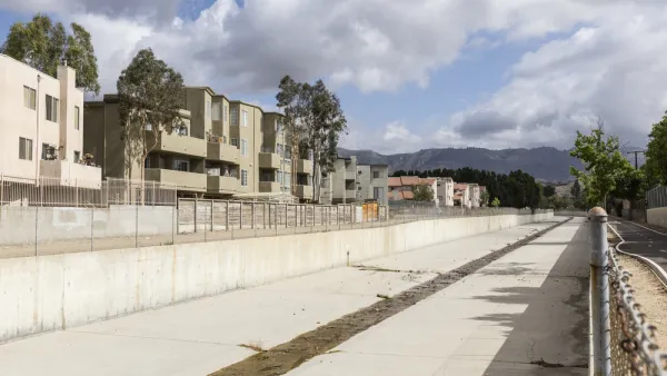
Regional officials don't think the federal government is doing enough to warrant continued ownership of the Los Angeles River flood control channels that cut a 40-mile path through the city and county.

"Los Angeles County officials are proposing to take ownership of 40 miles of flood-control channels along the Los Angeles River from the federal government in order to expedite maintenance and water conservation improvements as climate change increases the frequency of extreme weather," reports Louis Sahagun.
The announcement brings into focus the conflicting missions of regional flood control regulators and the federal government. The mission of the Army Corps of Engineers, according to a source from the County Department of Public Works cited in the article, "does not include myriad issues his agency’s County Flood Control District regards as essential: water conservation, movement of sediment, graffiti removal, ecosystem friendly vegetation, homeless encampments and recreational opportunities."
The county hopes to take control of the river channel to speed up the delivery of groundwater storage projects, habitat restoration, new open and space and recreation projects, and new residential, commercial, and office development, according to the article.
The article also includes a lot more detail about the many pressing improvements required of dam and stormwater control infrastructure along the river—more reasons the county wants to take ownership of the river channel.
FULL STORY: County wants authority over L.A. River flood-control channels owned by U.S. government

A Comment for the L.A. River Master Plan
Five themes proposed to achieve justice and sustainability for the Los Angeles River and its surrounding communities.

$300 Million Property Tax to Fund Stormwater Infrastructure on the Ballot in Los Angeles County
The proposed property tax would double the county's stormwater capture capacity.
The Changing Paradigm of Stormwater Management
In the past, stormwater management has been about flood control. The future of stormwater, however, is in capturing, treating, and recharging water supply, according to this article.

National Parks Layoffs Will Cause Communities to Lose Billions
Thousands of essential park workers were laid off this week, just before the busy spring break season.

Retro-silient?: America’s First “Eco-burb,” The Woodlands Turns 50
A master-planned community north of Houston offers lessons on green infrastructure and resilient design, but falls short of its founder’s lofty affordability and walkability goals.

Delivering for America Plan Will Downgrade Mail Service in at Least 49.5 Percent of Zip Codes
Republican and Democrat lawmakers criticize the plan for its disproportionate negative impact on rural communities.

Test News Post 1
This is a summary

Test News Headline 46
Test for the image on the front page.

Balancing Bombs and Butterflies: How the National Guard Protects a Rare Species
The National Guard at Fort Indiantown Gap uses GIS technology and land management strategies to balance military training with conservation efforts, ensuring the survival of the rare eastern regal fritillary butterfly.
Urban Design for Planners 1: Software Tools
This six-course series explores essential urban design concepts using open source software and equips planners with the tools they need to participate fully in the urban design process.
Planning for Universal Design
Learn the tools for implementing Universal Design in planning regulations.
EMC Planning Group, Inc.
Planetizen
Planetizen
Mpact (formerly Rail~Volution)
Great Falls Development Authority, Inc.
HUDs Office of Policy Development and Research
NYU Wagner Graduate School of Public Service