


In 1970, half of the city's census tracts were middle-income. Now, only 16 percent of them remain so. Polarization between the well-off and the poor essentially splits the city in two.
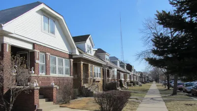
Researchers from the Nathalie P. Voorhees Center at the University of Illinois at Chicago have compiled a troubling set of maps showing how severely the city's middle class has shrunk over the past half-century.
"UIC's maps show that fully half of the city was middle income in 1970, including large swaths on every side of town," Linda Lutton writes. "Today, just 16 percent of the city's 797 census tracts are considered middle income. Those middle income areas are confined mostly to the corners of the city, and to thin strips between areas of wealth and poverty."
"Stubborn" racial segregation is one part of the story, as is the recent arrival of high-income households staking claims on the city's North Side. "Just 8 percent of Chicago's census tracts were considered high or very high income in 1970. Today, more than one-fifth of the city's census tracts are higher income." Low-income neighborhoods in the city's south and west tend to be majority black or Latino.
Meanwhile, says demographer Rob Paral, the North Side's rising affluence maps to education: people with higher degrees are replacing previous middle-class residents. Some affluent residents "buy half-million-dollar homes nearby that they tear down to use as side yards," according to a local realtor. "Two-flats, which middle-class families could afford because of the rental income, are now regularly converted to single-family homes," Lutton writes.
FULL STORY: The Middle Class Is Shrinking Everywhere — In Chicago It’s Almost Gone

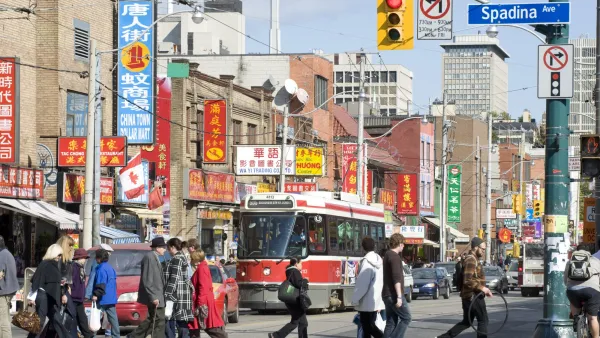
New Research Shows Toronto Highly Segregated Along Race and Class Lines
A closer look at the numbers reveals stark divides among Toronto neighborhoods.
Study: More Than Income, Race Influences Neighborhood Standards
Although income inequality receives plenty of coverage these days, research suggests that neighborhoods of color have less access to resources than white neighborhoods despite similar median incomes.
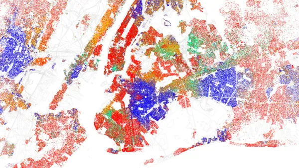
Examining the Surprising Segregation of New York City
The common perception of New York City is as of a well-integrated city, full of multi-ethnic neighborhoods. But a recent article peeks behind the curtain of the city’s surprising boundaries of racial segregation.

National Parks Layoffs Will Cause Communities to Lose Billions
Thousands of essential park workers were laid off this week, just before the busy spring break season.

Retro-silient?: America’s First “Eco-burb,” The Woodlands Turns 50
A master-planned community north of Houston offers lessons on green infrastructure and resilient design, but falls short of its founder’s lofty affordability and walkability goals.

Delivering for America Plan Will Downgrade Mail Service in at Least 49.5 Percent of Zip Codes
Republican and Democrat lawmakers criticize the plan for its disproportionate negative impact on rural communities.

Test News Post 1
This is a summary

Test News Headline 46
Test for the image on the front page.

Balancing Bombs and Butterflies: How the National Guard Protects a Rare Species
The National Guard at Fort Indiantown Gap uses GIS technology and land management strategies to balance military training with conservation efforts, ensuring the survival of the rare eastern regal fritillary butterfly.
Urban Design for Planners 1: Software Tools
This six-course series explores essential urban design concepts using open source software and equips planners with the tools they need to participate fully in the urban design process.
Planning for Universal Design
Learn the tools for implementing Universal Design in planning regulations.
EMC Planning Group, Inc.
Planetizen
Planetizen
Mpact (formerly Rail~Volution)
Great Falls Development Authority, Inc.
HUDs Office of Policy Development and Research
NYU Wagner Graduate School of Public Service