


Analyzing the potential outcomes of Senate Bill 10, one of two statewide upzoning bills under consideration in the state of Oregon this year.
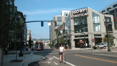
Michael Andersen digs into the details of one of the big land use bills under consideration in the Oregon Legislature—SB 10, which would "legalize hundreds of thousands of potential future homes, almost all of them in three urban areas: Portland, Eugene-Springfield, and Salem."
The bill would allow new levels of density around transit lines, and remove parking requirements for new development neat transit stops.
"There’s compelling logic to it," writes Andersen. "Oregonians have spent billions of dollars on their mass transit systems and spend more than a billion more every year. Why not let people live near them if they want to?"
The bill would have especially broad reach in Portland, where TriMet has mapped the areas of the city that would be affected by the zoning changes mandated by Senate Bill 10 (click through to see the map).
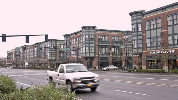
The bill offers a kind of sliding scale for the kinds of density that would be legalized, depending on the size of the city and the capacity of nearby transit lines. Andersen collects examples of the varying degrees of density that would be possible if the legislature approves the bill. (Senate Bill is not to be confused with House Bill 2001, which would end single-family zoning in all cities in the state with a population over 10,000.)
FULL STORY: HERE’S WHAT OREGON’S HUGE NEW TRANSIT HOUSING BILL WOULD LEGALIZE

Oregon to Consider New Densities for Transit Adjacent Neighborhoods
The Oregon Legislature is already considering one of the most sweeping and ambitious statewide land use reform bills in the country. A new bill would allow even more density around transit stations.
South L.A. Townhall Opposes SB 1120 Statewide Upzoning Bill
L.A. City Councilmembers Herb Wesson and Paul Koretz register opposition to SB 1120, calling the bill an attack on the residential integrity throughout the state of California.

Virginia Upzoning and Accessory Dwelling Unit Bills Killed Quickly in Committee
The Land Use subcommittee of the Virginia House of Delegates decided quickly to uphold local control of zoning.

National Parks Layoffs Will Cause Communities to Lose Billions
Thousands of essential park workers were laid off this week, just before the busy spring break season.

Retro-silient?: America’s First “Eco-burb,” The Woodlands Turns 50
A master-planned community north of Houston offers lessons on green infrastructure and resilient design, but falls short of its founder’s lofty affordability and walkability goals.

Delivering for America Plan Will Downgrade Mail Service in at Least 49.5 Percent of Zip Codes
Republican and Democrat lawmakers criticize the plan for its disproportionate negative impact on rural communities.

Test News Post 1
This is a summary

Test News Headline 46
Test for the image on the front page.

Balancing Bombs and Butterflies: How the National Guard Protects a Rare Species
The National Guard at Fort Indiantown Gap uses GIS technology and land management strategies to balance military training with conservation efforts, ensuring the survival of the rare eastern regal fritillary butterfly.
Urban Design for Planners 1: Software Tools
This six-course series explores essential urban design concepts using open source software and equips planners with the tools they need to participate fully in the urban design process.
Planning for Universal Design
Learn the tools for implementing Universal Design in planning regulations.
EMC Planning Group, Inc.
Planetizen
Planetizen
Mpact (formerly Rail~Volution)
Great Falls Development Authority, Inc.
HUDs Office of Policy Development and Research
NYU Wagner Graduate School of Public Service