


The use of level of service (LOS) to gauge the success of roadway networks has shaped and influenced cities in many negative ways.
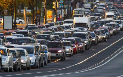
Lara Fishbane, Joseph Kane, and Adie Tomer of Brookings take a closer look at the level of service measure and the problems its use causes. LOS essentially measures congestion, but it also guides transportation planning as decision makers, planners, and other stakeholders work to improve LOS scores.
When LOS is used in efforts to address congestion, the solution too often is to build more roads, say Fishbane, Kane, and Tomer. The results are sprawl and transportation networks that decimate communities and privilege cars over other modes. "In short, the auto-centric development LOS makes possible has become one of the greatest obstacles to transportation choice and access, economic agglomeration, and environmental resilience."
They argue that different measures are needed — for example, multimodal measures and those that consider vehicle miles traveled instead of LOS. "Decreasing reliance on LOS also means introducing measures that don’t lead with transportation use, but instead with measures related to economic, social, and environmental outcomes," point out Fishbane, Kane, and Tomer.
In addition, they urge a shift away from a supply focus, which supports LOS, to one on travel demand. The result, they say, will be a better understanding of why people travel, how transportation systems can better serve users, and ways travel behavior can be changed.
FULL STORY: Stop trying to solve traffic and start building great places


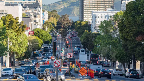
Shifting the Focus for Transportation Planning in Fairfax County
Fairfax County wants to move away from a heavy reliance on level of service in favor of more pedestrian- and transit-oriented planning.
Caltrans to Ditch Level of Service for Vehicle Miles Traveled
Unlike for land use regulations, state law doesn't require Caltrans to switch from Level of Service to Vehicle Miles Traveled in measuring the environmental impact of projects. The state department of transportation is making the change anyway.

Kids Still Aren't Walking to School
Two generations ago, most children walked to school. But the numbers have dropped significantly.

National Parks Layoffs Will Cause Communities to Lose Billions
Thousands of essential park workers were laid off this week, just before the busy spring break season.

Retro-silient?: America’s First “Eco-burb,” The Woodlands Turns 50
A master-planned community north of Houston offers lessons on green infrastructure and resilient design, but falls short of its founder’s lofty affordability and walkability goals.

Delivering for America Plan Will Downgrade Mail Service in at Least 49.5 Percent of Zip Codes
Republican and Democrat lawmakers criticize the plan for its disproportionate negative impact on rural communities.

Test News Post 1
This is a summary

Test News Headline 46
Test for the image on the front page.

Balancing Bombs and Butterflies: How the National Guard Protects a Rare Species
The National Guard at Fort Indiantown Gap uses GIS technology and land management strategies to balance military training with conservation efforts, ensuring the survival of the rare eastern regal fritillary butterfly.
Urban Design for Planners 1: Software Tools
This six-course series explores essential urban design concepts using open source software and equips planners with the tools they need to participate fully in the urban design process.
Planning for Universal Design
Learn the tools for implementing Universal Design in planning regulations.
EMC Planning Group, Inc.
Planetizen
Planetizen
Mpact (formerly Rail~Volution)
Great Falls Development Authority, Inc.
HUDs Office of Policy Development and Research
NYU Wagner Graduate School of Public Service