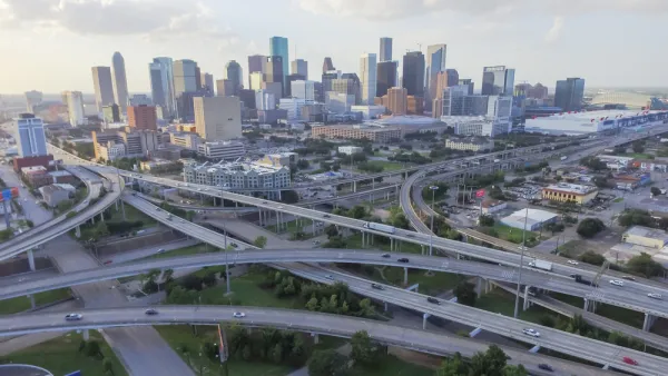
The environmental impact report for the North Houston Highway Improvement Project is still underway, after 15 years of planning, but it's not too early to imagine the consequences of this massive project.
William Fulton kicks off a series on a massive highway project in Houston that will widen Interstate 45 at an estimated cost of $7 to $10 billion. "Looking beyond its sheer size, the project will shape mobility and development patterns for decades to come," writes Fulton.
The North Houston Highway Improvement Project (NHHIP, popularly referred to as "the I-45 project," has been in the works for 15 years, with the intention "[tackling] mobility problems all the way from North Houston to Midtown, south of downtown." Fulton explains the scope of the project in more detail:
On the North Side, TxDOT will widen I-45 to accommodate high-occupancy vehicle lanes and will likely expand the frontage road on both sides.
Through Downtown, the project would re-route I-45 alongside I-69 (the former Highway 59) to the east of the George R. Brown Convention Center (GRB) and decommission, if not remove, the Pierce Elevated, thus reconnecting Downtown and Midtown. A seven-block “cap” will cover the freeway behind the GRB, creating the possibility of a park that reconnects Downtown to EaDo. South of Downtown, TxDOT will change I-69 from elevated to depressed, connecting it to the depressed I-69 freeway through Montrose and several small caps will be constructed over the freeway near Main Street. Proposed plans can be seen in the video below.
The Rice Kinder Institute for Urban Research published Fulton's article on its blog, Urban Edge, as a first in a series of articles that will give experts a chance to weight in on the implications of the project for the city of Houston.
The second article in the series was written by Bob Eury, and describes the projects as a "once-in-a-lifetime" opportunity.
FULL STORY: Experts to share what TxDOT's I-45 project means for Houston

National Parks Layoffs Will Cause Communities to Lose Billions
Thousands of essential park workers were laid off this week, just before the busy spring break season.

Retro-silient?: America’s First “Eco-burb,” The Woodlands Turns 50
A master-planned community north of Houston offers lessons on green infrastructure and resilient design, but falls short of its founder’s lofty affordability and walkability goals.

Delivering for America Plan Will Downgrade Mail Service in at Least 49.5 Percent of Zip Codes
Republican and Democrat lawmakers criticize the plan for its disproportionate negative impact on rural communities.

Test News Post 1
This is a summary

Test News Headline 46
Test for the image on the front page.

Balancing Bombs and Butterflies: How the National Guard Protects a Rare Species
The National Guard at Fort Indiantown Gap uses GIS technology and land management strategies to balance military training with conservation efforts, ensuring the survival of the rare eastern regal fritillary butterfly.
Urban Design for Planners 1: Software Tools
This six-course series explores essential urban design concepts using open source software and equips planners with the tools they need to participate fully in the urban design process.
Planning for Universal Design
Learn the tools for implementing Universal Design in planning regulations.
EMC Planning Group, Inc.
Planetizen
Planetizen
Mpact (formerly Rail~Volution)
Great Falls Development Authority, Inc.
HUDs Office of Policy Development and Research
NYU Wagner Graduate School of Public Service


