


Brookings buils on the findings of recent research about jobs densification in cities around the country to make a larger point about the benefits of proximity in urban design, as compared to sprawl.

"New research from the Bass Center for Transformative Placemaking at Brookings confirms that when it comes to site selection, American businesses continue to value proximity."
Adie Tomer, Joseph W. Kane, and Lara Fishbane write to explain the findings of the research referenced above, tying transportation and land use planning to the discussion as the "ultimate enablers of proximity."
"The character of our urban form—including density, permitted use in buildings, and transportation designs—will either promote closer proximity or push economic activity further apart. And despite the best efforts of many business and civic leaders, the prevailing transportation model in the United States downplays distance and focuses too much on traffic," according to the article.
Earlier this month, Planetizen picked up the news of the research cited here, but the current article more explicitly ties the findings of the study to planning policies and more explicitly appeals for a shift toward less car-oriented sprawl.
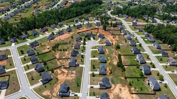
"We propose a new model: prioritizing human-scale proximity and the shorter-distance travel it promotes," according to the article, before laying out a list of five benefits to more proximity and less sprawl, with more detail in the source article:
- Proximity promotes agglomeration, helping to grow industries and regional economies.
- Proximity requires less infrastructure per capita, reducing fiscal burdens on communities.
- Proximity offers more modal choice, making transportation more affordable and age-neutral.
- Proximity is essential to hitting carbon targets and developing more resilient places.
- Proximity incentivizes safer streets and supports a healthier population.
The article also includes one critical caveat: the proposal does not necessitate a Cobursian approach to urban development that would replicate skyscrapers all over urban areas. To get at the right mix of densities, the trio of writers suggests making better use of the new troves of transportation data available to planners.
FULL STORY: Connecting people by proximity: A better way to plan metro areas


Commentary: We Need a Return to the Adaptability of Traditional Urban Form
How the rigidity of modern suburban development fails to prepare cities for the future.
Commentary: Minimum Lot Sizes Drive Up Housing Costs
How making residential building requirements more flexible can ease the housing crisis and make neighborhoods more livable for more households.

Maine Law Promotes Smart Growth
New state legislation encourages cities to plan around ‘smart growth’ principles to preserve farmland and open space, and use infill development to build more housing.

National Parks Layoffs Will Cause Communities to Lose Billions
Thousands of essential park workers were laid off this week, just before the busy spring break season.

Retro-silient?: America’s First “Eco-burb,” The Woodlands Turns 50
A master-planned community north of Houston offers lessons on green infrastructure and resilient design, but falls short of its founder’s lofty affordability and walkability goals.

Delivering for America Plan Will Downgrade Mail Service in at Least 49.5 Percent of Zip Codes
Republican and Democrat lawmakers criticize the plan for its disproportionate negative impact on rural communities.

Test News Post 1
This is a summary

Test News Headline 46
Test for the image on the front page.

Balancing Bombs and Butterflies: How the National Guard Protects a Rare Species
The National Guard at Fort Indiantown Gap uses GIS technology and land management strategies to balance military training with conservation efforts, ensuring the survival of the rare eastern regal fritillary butterfly.
Urban Design for Planners 1: Software Tools
This six-course series explores essential urban design concepts using open source software and equips planners with the tools they need to participate fully in the urban design process.
Planning for Universal Design
Learn the tools for implementing Universal Design in planning regulations.
EMC Planning Group, Inc.
Planetizen
Planetizen
Mpact (formerly Rail~Volution)
Great Falls Development Authority, Inc.
HUDs Office of Policy Development and Research
NYU Wagner Graduate School of Public Service