


Under the transit tab on Google Maps, users will now be able to incorporate trips that start on a bike but end on a bus, train, or other mode of transport.

Google now offers multi-modal directions on some platforms. Travelers can use their phones not only to look up transit, walking, car, or biking directions, but now they can also use the service to get directions that incorporate multiple modes. This new feature is meant to help give information relevant to each leg of a multimodal journey including information about how crowded trains are, what traffic is like, and how long one would be likely to wait for a train.
"Transit directions paired with ride-sharing and biking will start rolling today out on iOS. Android users will also get transit plus ride-sharing starting today, but they will have to wait a little longer for transit plus biking," Andrew J. Hawkins reports for the Verge.
FULL STORY: Google Maps will now let users combine transit directions with biking and ride-sharing


Two Years In, a Look at the Twin Cities Fare Discount Program
In 2017, Metro Transit in the Twin Cities raised fares but also started a program for low-income riders to help ease the burden of travel costs.
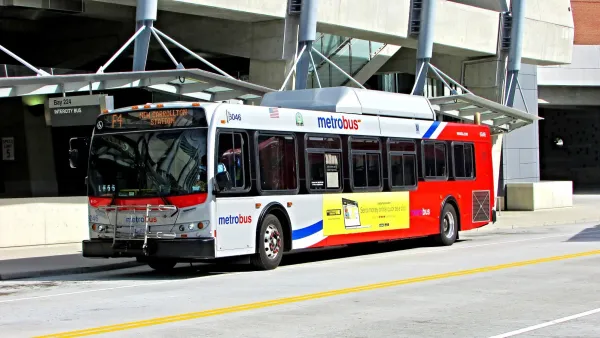
D.C.-Area Residents Want Bus Lanes and Free Transfers, Survey Shows
New survey findings identify transit priorities among residents in D.C. and surrounding areas, and indicate broad support for public investments.

Google's New 'Visual Position System' Takes Pedestrian Navigation to the Next Level
In case you've ever felt like Google Maps isn't as helpful on foot as it is in a car, there's a new technology just for you.

National Parks Layoffs Will Cause Communities to Lose Billions
Thousands of essential park workers were laid off this week, just before the busy spring break season.

Retro-silient?: America’s First “Eco-burb,” The Woodlands Turns 50
A master-planned community north of Houston offers lessons on green infrastructure and resilient design, but falls short of its founder’s lofty affordability and walkability goals.

Delivering for America Plan Will Downgrade Mail Service in at Least 49.5 Percent of Zip Codes
Republican and Democrat lawmakers criticize the plan for its disproportionate negative impact on rural communities.

Test News Post 1
This is a summary

Test News Headline 46
Test for the image on the front page.

Balancing Bombs and Butterflies: How the National Guard Protects a Rare Species
The National Guard at Fort Indiantown Gap uses GIS technology and land management strategies to balance military training with conservation efforts, ensuring the survival of the rare eastern regal fritillary butterfly.
Urban Design for Planners 1: Software Tools
This six-course series explores essential urban design concepts using open source software and equips planners with the tools they need to participate fully in the urban design process.
Planning for Universal Design
Learn the tools for implementing Universal Design in planning regulations.
EMC Planning Group, Inc.
Planetizen
Planetizen
Mpact (formerly Rail~Volution)
Great Falls Development Authority, Inc.
HUDs Office of Policy Development and Research
NYU Wagner Graduate School of Public Service