


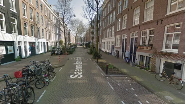
Eve Kessler shares news of a new film from Streetfilms that documents the efforts of a neighborhood in Amsterdam to activate a street liberated from parking.
"Residents of the Frans Halsbuurt neighborhood joined with their District Alderman Rocco Piers and city planners this year to create public amenities in the space freed up by the removal of 600 parking spots," writes Kessler.
"So they and the designers turned the former parking spaces to such uses as bike parking, a sandbox-trampoline combination, loading zones for freight delivery, and land for a curbside garden. The re-envisioned neighborhood is the kind of car-free, kid-friendly oasis," adds Kessler.
The description of the video posted on Vimeo explains the circumstances of the film's creation:
Mark Gorton, the Chairman of Open Plans was curious to the exact decision process came about to remove on-street parking in the Frans Halsbuurt neighborhood , so he flew to Amsterdam to meet with Rocco Piers, the district alderman who is helping usher in a new way of allowing residents of streets to get together and re-design them the way they would like to see.
The film is also presented as a follow up to the film, "Amsterdam's Removing 10,000 Parking Spaces: See what's possible!" published three months ago.
FULL STORY: STREETFILMS: Letting Citizens Redesign Their Streets

Watch: How to Remove Thousands of Parking Spaces
What the city of Amsterdam will gain by removing cars from on-street parking space.

Rather Than Banning Cars, Amsterdam Reduces On-Street Parking
Amsterdam will pursue the Oslo model of targeting parking spots, rather than driving bans, to make for a walk-and-bike friendly city. On-street parking spaces will gradually be replaced, starting July 1, with bike lanes, sidewalks, and trees.

Parking Study: Scooter Scofflaws Far Outnumbered by Car Scofflaws
The worst offenders of parking violations on the streets today aren't scooters—they're food delivery and ride-hailing drivers.

National Parks Layoffs Will Cause Communities to Lose Billions
Thousands of essential park workers were laid off this week, just before the busy spring break season.

Retro-silient?: America’s First “Eco-burb,” The Woodlands Turns 50
A master-planned community north of Houston offers lessons on green infrastructure and resilient design, but falls short of its founder’s lofty affordability and walkability goals.

Delivering for America Plan Will Downgrade Mail Service in at Least 49.5 Percent of Zip Codes
Republican and Democrat lawmakers criticize the plan for its disproportionate negative impact on rural communities.

Test News Post 1
This is a summary

Test News Headline 46
Test for the image on the front page.

Balancing Bombs and Butterflies: How the National Guard Protects a Rare Species
The National Guard at Fort Indiantown Gap uses GIS technology and land management strategies to balance military training with conservation efforts, ensuring the survival of the rare eastern regal fritillary butterfly.
Urban Design for Planners 1: Software Tools
This six-course series explores essential urban design concepts using open source software and equips planners with the tools they need to participate fully in the urban design process.
Planning for Universal Design
Learn the tools for implementing Universal Design in planning regulations.
EMC Planning Group, Inc.
Planetizen
Planetizen
Mpact (formerly Rail~Volution)
Great Falls Development Authority, Inc.
HUDs Office of Policy Development and Research
NYU Wagner Graduate School of Public Service