


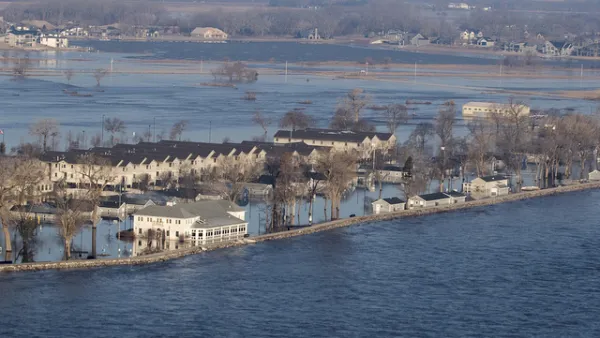
The New York Times has published a spectacular mapping and data project to show the extent of flooding along the Mississippi River and its tributaries in the winter, spring, and summer of 2019.

Sarah Almukhtar, Blacki Migliozzi, John Schwartz, and Josh Williams are credited on the byline for an interactive feature that is a stunning piece of mapping and data reporting.
"The year's flooding across the Midwest and the South affected nearly 14 million people, yet the full scale of the slowly unfolding disaster has been difficult to fathom," according to the blurb that introduces the map. "To visualize just how extensive it was, The New York Times created this composite map showing all the areas that were inundated at some point from January to June."
Satellite data is used to show the extent of flooding compared to the usual edges of rivers. Farms that had to delay planting are also shown on the map, along with tags to document property destruction.
FULL STORY: The Great Flood of 2019: A Complete Picture of a Slow-Motion Disaster

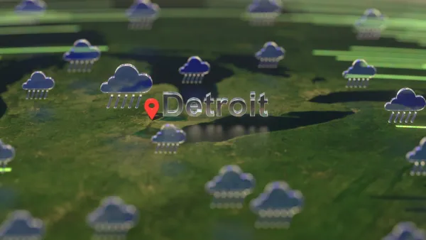
Flooding in the Midwest Shows There's No Refuge From Climate Change
While projections say areas of the U.S. Midwest around the Great Lakes will become more hospitable as the climate changes, stormwater and flooding is still a challenge in a surprising number of locations.
Vital Lessons From the Midwest Bomb Cyclone and Flooding of 2019
The floodwaters still haven't subsided in parts of the Midwest, and lessons about climate change, extreme weather and proactive planning are badly needed to avoid similar catastrophes in the future.

A Toolbox of Green Infrastructure Solutions to Flooding Risks
A new one-stop shop for green infrastructure solutions is available to planners and engineers challenged by flooding.

Analysis: Cybertruck Fatality Rate Far Exceeds That of Ford Pinto
The Tesla Cybertruck was recalled seven times last year.

National Parks Layoffs Will Cause Communities to Lose Billions
Thousands of essential park workers were laid off this week, just before the busy spring break season.

Retro-silient?: America’s First “Eco-burb,” The Woodlands Turns 50
A master-planned community north of Houston offers lessons on green infrastructure and resilient design, but falls short of its founder’s lofty affordability and walkability goals.

Test News Post 1
This is a summary

Analysis: Cybertruck Fatality Rate Far Exceeds That of Ford Pinto
The Tesla Cybertruck was recalled seven times last year.

Test News Headline 46
Test for the image on the front page.
Urban Design for Planners 1: Software Tools
This six-course series explores essential urban design concepts using open source software and equips planners with the tools they need to participate fully in the urban design process.
Planning for Universal Design
Learn the tools for implementing Universal Design in planning regulations.
EMC Planning Group, Inc.
Planetizen
Planetizen
Mpact (formerly Rail~Volution)
Great Falls Development Authority, Inc.
HUDs Office of Policy Development and Research
NYU Wagner Graduate School of Public Service