


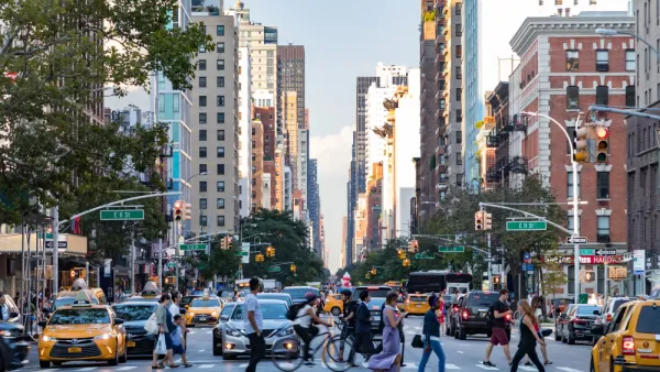
New York City will create green waves by adjusting traffic signals to keep cyclists moving, even when drivers will have to slow down.

Winnie Hu reports on plans in New York City to retime traffic signals to give cyclists priority. The strategy will recalibrate signals for cyclists, who travel about 10 to 15 miles per hour, by giving them a series of green lights and stopping drivers traveling above 15 miles per hour.
"New York’s experiment with what has been called a green wave is part of a global movement to make urban streets more welcoming to bikes, even as the country’s streets have become more dangerous," writes Hu. With a green wave system in place, traffic also runs more smoothly and the potential for crashes decreases as cyclists and motorists stop speeding up to try to beat red lights.
Copenhagen was the first city to adapt the concept of the green wave for biking. In the United States, traffic signals have been adjusted on streets in San Francisco, Chicago, and Portland, Oregon. New York City had implemented a green wave on a small segment of a Brooklyn roadway and plans to expand it to other streets in Brooklyn, Manhattan, and Queens.
FULL STORY: After Cyclist Deaths, City Adjusts Traffic Lights to Slow Cars


Has Progress on Travel Safety Run Off the Road?
Changing technology and rebuilding infrastructure to improve road safety are long-term strategies. How can enforcement and interventions that influence driver behavior make a difference in reducing traffic deaths sooner?
NYC Congestion Pricing May Be Saving Lives
According to preliminary data, crashes and injuries dropped dramatically within the city’s new congestion relief zone.
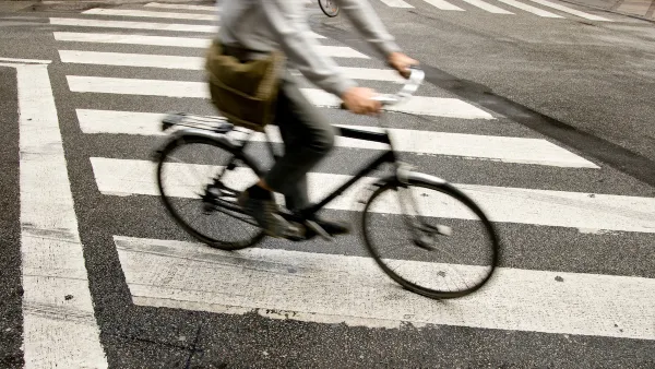
A Little-Known Loophole Puts Cyclists at Risk
Crosswalk laws in most U.S. states don’t offer legal protections to people on bikes, scooters, or mobility devices.

National Parks Layoffs Will Cause Communities to Lose Billions
Thousands of essential park workers were laid off this week, just before the busy spring break season.

Retro-silient?: America’s First “Eco-burb,” The Woodlands Turns 50
A master-planned community north of Houston offers lessons on green infrastructure and resilient design, but falls short of its founder’s lofty affordability and walkability goals.

Delivering for America Plan Will Downgrade Mail Service in at Least 49.5 Percent of Zip Codes
Republican and Democrat lawmakers criticize the plan for its disproportionate negative impact on rural communities.

Test News Post 1
This is a summary

Test News Headline 46
Test for the image on the front page.

Balancing Bombs and Butterflies: How the National Guard Protects a Rare Species
The National Guard at Fort Indiantown Gap uses GIS technology and land management strategies to balance military training with conservation efforts, ensuring the survival of the rare eastern regal fritillary butterfly.
Urban Design for Planners 1: Software Tools
This six-course series explores essential urban design concepts using open source software and equips planners with the tools they need to participate fully in the urban design process.
Planning for Universal Design
Learn the tools for implementing Universal Design in planning regulations.
EMC Planning Group, Inc.
Planetizen
Planetizen
Mpact (formerly Rail~Volution)
Great Falls Development Authority, Inc.
HUDs Office of Policy Development and Research
NYU Wagner Graduate School of Public Service