


An analysis of Lime bikeshare data from Boston suburbs is providing useful information about travel behavior and trends.

"The Metropolitan Area Planning Council facilitated contracts between multiple Boston suburbs and Lime, a bike-sharing company, and received anonymized data on 300,000 trips as part of an agreement with the company," reports Andy Metzger. MAPC released a research brief with analysis of the 18 months of data about dockless bikeshare in the metropolitan Boston area.
"According to the data, about 18 percent of miles traveled by Lime bikers were on stretches classified as 'very high stress' – roadways where the lane configurations and traffic make them especially risky for bike-car crashes," writes Metzger. The findings also indicate that about 44 percent of Lime trips are happening on multiuse paths, and riders’ destinations include a mix of urban centers, residential areas, and transit stops.
The agency says its analysis of Lime travel data will help guide future planning efforts and development of safe infrastructure and strategies to encourage non-auto travel. "Asserting that similar data-sharing arrangements should be standard for all new mobility forms – including scooters, autonomous vehicles, and drones – MAPC plans to keep crunching the numbers," adds Metzger.
FULL STORY: Lime riders traverse dangerous roadways

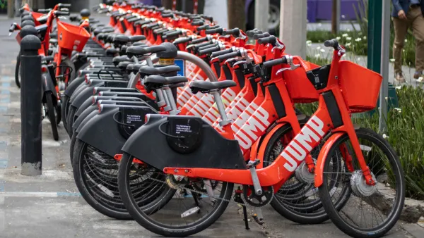
The Fall of JUMP Bikes
An exposé of the dramatic rise and fall of JUMP bikes under the ownership of Uber, in partnership with cities all over the United States.

Boston's Bikeshare System Gets a New Partner, Rebranding
Blue Cross will pay $18 million for a six-year sponsorship of the Boston-area bikeshare system formerly known as Hubway.

Multiple Studies Find Ride-Hailing Contributes to Congestion and Transit Losses
Surveys on ride-hailing conducted by regional planning agencies, academic institutions, and public transit agencies throughout the U.S. reviewed by the Associated Press largely led to the same conclusion: more traffic and reduced use of transit.

National Parks Layoffs Will Cause Communities to Lose Billions
Thousands of essential park workers were laid off this week, just before the busy spring break season.

Retro-silient?: America’s First “Eco-burb,” The Woodlands Turns 50
A master-planned community north of Houston offers lessons on green infrastructure and resilient design, but falls short of its founder’s lofty affordability and walkability goals.

Delivering for America Plan Will Downgrade Mail Service in at Least 49.5 Percent of Zip Codes
Republican and Democrat lawmakers criticize the plan for its disproportionate negative impact on rural communities.

Test News Post 1
This is a summary

Test News Headline 46
Test for the image on the front page.

Balancing Bombs and Butterflies: How the National Guard Protects a Rare Species
The National Guard at Fort Indiantown Gap uses GIS technology and land management strategies to balance military training with conservation efforts, ensuring the survival of the rare eastern regal fritillary butterfly.
Urban Design for Planners 1: Software Tools
This six-course series explores essential urban design concepts using open source software and equips planners with the tools they need to participate fully in the urban design process.
Planning for Universal Design
Learn the tools for implementing Universal Design in planning regulations.
EMC Planning Group, Inc.
Planetizen
Planetizen
Mpact (formerly Rail~Volution)
Great Falls Development Authority, Inc.
HUDs Office of Policy Development and Research
NYU Wagner Graduate School of Public Service