


Toronto’s iconic Yonge Street is heavily used by pedestrians, and, according to this article, it's time for a revamp that acknowledges all of the street's users.
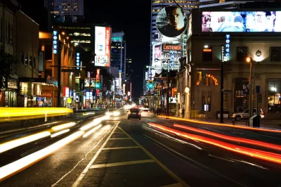
Matt Elliott makes the case for redesigning Yonge Street in Toronto to better accommodate pedestrians. "For a street so full of people — no street in Canada sees more daily pedestrian traffic than downtown Yonge Street — it feels hostile to pedestrians. It’s all narrow sidewalks and backed-up intersections."
As the population of the area is expected to grow in coming years, the street needs a design strategy that will account for increased foot traffic, says Elliott. "At all intersections in the core area, pedestrians make up between 50 per cent and 75 per cent of all traffic, but get less than 25 per cent of the road space."
The city of Toronto is hosting a series of public events, part of a study called yongeTOmorrow, to gather feedback about design options for Yonge Street. Two of the design options would narrow the roadway and increase pedestrian space. The third option, however, would ban most vehicles. "For much of the day, it would turn the entire street over to pedestrians. No cars and no trucks. Just people," notes Elliott.
FULL STORY: Give downtown Yonge St. to pedestrians

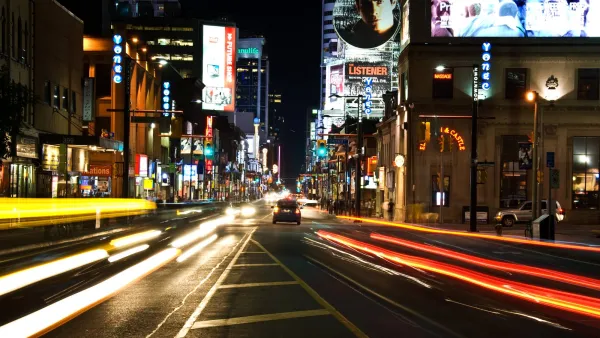
Pedestrian-Friendly Makeover of a Busy Toronto Street Stops Short of the Car-Free Ideal
The yongeTOmorrrow project is heading toward the finish line with widespread support from advocates, but a few want the plan to go one step further.
Denver to Shift Sidewalk Repair Work to City, Funded by Property Owners
The city is shifting from a piecemeal approach to sidewalk repairs that charged property owners with doing the work to a more streamlined, city-led process.
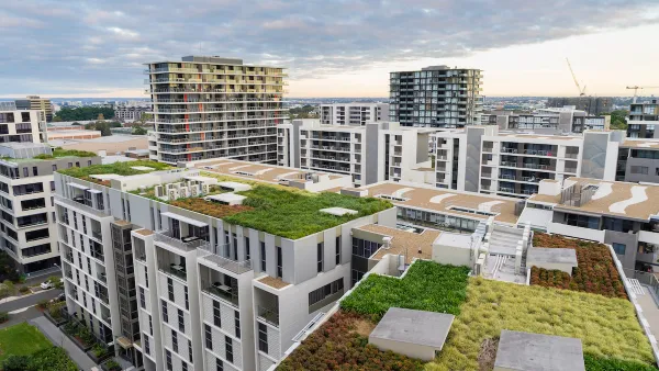
Where Urban Design Is Headed in 2024
A forecast of likely trends in urban design and architecture.

National Parks Layoffs Will Cause Communities to Lose Billions
Thousands of essential park workers were laid off this week, just before the busy spring break season.

Retro-silient?: America’s First “Eco-burb,” The Woodlands Turns 50
A master-planned community north of Houston offers lessons on green infrastructure and resilient design, but falls short of its founder’s lofty affordability and walkability goals.

Delivering for America Plan Will Downgrade Mail Service in at Least 49.5 Percent of Zip Codes
Republican and Democrat lawmakers criticize the plan for its disproportionate negative impact on rural communities.

Test News Post 1
This is a summary

Test News Headline 46
Test for the image on the front page.

Balancing Bombs and Butterflies: How the National Guard Protects a Rare Species
The National Guard at Fort Indiantown Gap uses GIS technology and land management strategies to balance military training with conservation efforts, ensuring the survival of the rare eastern regal fritillary butterfly.
Urban Design for Planners 1: Software Tools
This six-course series explores essential urban design concepts using open source software and equips planners with the tools they need to participate fully in the urban design process.
Planning for Universal Design
Learn the tools for implementing Universal Design in planning regulations.
EMC Planning Group, Inc.
Planetizen
Planetizen
Mpact (formerly Rail~Volution)
Great Falls Development Authority, Inc.
HUDs Office of Policy Development and Research
NYU Wagner Graduate School of Public Service