


A writer in Toronto imagines how the city would be evaluated according to a "Run Score"—a fast-paced version of the Walk Score.
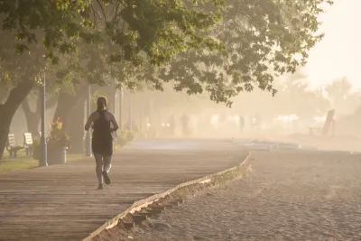
Alexander Bimm writes from Toronto, which has already seen a fair amount of research and investment into the city's walkability, resulting in a position as the second most walkable city in Canada. Given the health benefits, and even potentially the mobility benefits, of running, Bimm wonders about what it would take to produce a new runnability index, something called a "Run Score."
According to Bimm, Toronto has a network of trails that offer runners an embarrassment of riches that could help with a Run Score: "what makes Toronto so great for running is that you can run from your door and promptly arrive to a great network of trails within 10 minutes. In some other cities, by contrast, he has to bike or drive to a nearby trail before starting his run."
As for how the Run Score would be calculated, it would probably resemble the Walk Score. "But scoring runnability might also consider new factors that are based on how convenient it is for people to run in that area," according to Bimm. "In particular, a run score could highlight areas in the city that have access to running facilities and well-maintained trails. It can also consider the topography and speed limits of a neighbourhood."
Bimm also makes the case that the hypothetical run score could benefit planners by notifying them of parts of the city that need additional investments in public health. Residents would benefit by more awareness to the kinds of infrastructure that supports a healthy lifestyle.
FULL STORY: Run Score: Mapping Toronto’s Runnability

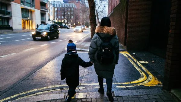
London Low-Emissions Zone Prompts Shift to Active Modes
More children are using active transportation modes to get to school in the wake of a policy that charges drivers to enter a low-emissions zone in central London.
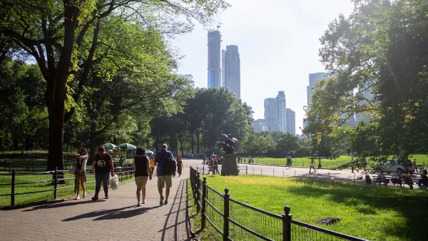
Green Spaces Benefit Neighborhoods—When Residents can Reach Them
A study comparing green space and walkability scores found that, without effective access to local parks, residents of greener neighborhoods don’t reap the health benefits.

How Long Covid Changes the Transportation Conversation
People living with long Covid symptoms can find themselves unable to make the same mobility choices they used to.

National Parks Layoffs Will Cause Communities to Lose Billions
Thousands of essential park workers were laid off this week, just before the busy spring break season.

Retro-silient?: America’s First “Eco-burb,” The Woodlands Turns 50
A master-planned community north of Houston offers lessons on green infrastructure and resilient design, but falls short of its founder’s lofty affordability and walkability goals.

Delivering for America Plan Will Downgrade Mail Service in at Least 49.5 Percent of Zip Codes
Republican and Democrat lawmakers criticize the plan for its disproportionate negative impact on rural communities.

Test News Post 1
This is a summary

Test News Headline 46
Test for the image on the front page.

Balancing Bombs and Butterflies: How the National Guard Protects a Rare Species
The National Guard at Fort Indiantown Gap uses GIS technology and land management strategies to balance military training with conservation efforts, ensuring the survival of the rare eastern regal fritillary butterfly.
Urban Design for Planners 1: Software Tools
This six-course series explores essential urban design concepts using open source software and equips planners with the tools they need to participate fully in the urban design process.
Planning for Universal Design
Learn the tools for implementing Universal Design in planning regulations.
EMC Planning Group, Inc.
Planetizen
Planetizen
Mpact (formerly Rail~Volution)
Great Falls Development Authority, Inc.
HUDs Office of Policy Development and Research
NYU Wagner Graduate School of Public Service