


An article details the efforts of Madison-area researchers to glean lessons from the transportation patterns of March and April to inform better planning for the future.
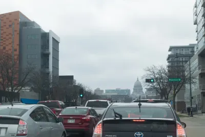
The reduced and altered transportation patterns of the pandemic presented a 'real-life experiment' in transportation engineering and planning, according to an article by Chris Hubbuch. The decreased numbers of cars and increased numbers of pedestrians and people on bikes offered researchers, "a way to study changes in traffic patterns that are typically hypothetical, allowing them to better understand traffic flows, pinpoint potential trouble spots and rethink the future of urban transportation."
The coverage relies on the expert insights of researchers from UW-Madison’s Traffic Operations and Safety (TOPS) Laboratory, which has approached the transportation effects of the pandemic as a "long-term window to study a system-wide reduction and compare highway performance to computer models." According to Jon Riehl, a traffic engineer and researcher at the lab cited in the article, the experiment could ultimately lead to "improvement in highway design and traffic engineering."
The article specifically notes that a reduction in automobile traffic was the only change on streets during the pandemic. "At the same time as it slashed automobile traffic, the pandemic response led to a surge in bicycle and foot traffic on suddenly crowded paths and sidewalks, creating a chance for planners to try out new configurations," according to Hubbuch.
According to Yang Tao, a traffic engineer for the city of Madison also paraphrased in the article, "one of the biggest lessons of the pandemic is that transportation systems should be designed with more than just one scenario in mind, a system that can easily shift to accommodate walking and biking, loading zones, outdoor seating or surges in traffic when other roads are closed by flooding, as they were in 2018."
FULL STORY: The pandemic response slashed traffic; what did it teach us about transportation planning?

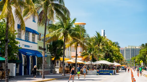
Cars Retake Their Place on Ocean Drive in Miami Beach
Ocean Drive in South Beach is the site of an ongoing pilot project in making space for pedestrians and businesses in space previously devoted to cars. Advocates and some local politicians don't like the direction that the experiment is headed.
Five Borough Bikeway Plan Released
The Regional Plan Association is calling on New York City to implement an ambitious plan to transform the city into a world class city for biking—for the benefit of the public health and economic realities of the pandemic and beyond.
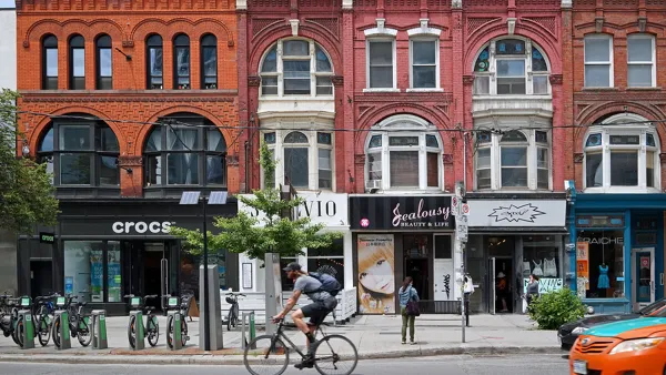
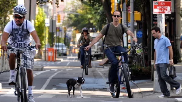
Biking Takes Off in Toronto
People in cities all over the world are choosing the bike as their preferred mode of transportation as the coronavirus shakes up work and travel patterns. Residents of the largest city in Canada are no exception.

National Parks Layoffs Will Cause Communities to Lose Billions
Thousands of essential park workers were laid off this week, just before the busy spring break season.

Retro-silient?: America’s First “Eco-burb,” The Woodlands Turns 50
A master-planned community north of Houston offers lessons on green infrastructure and resilient design, but falls short of its founder’s lofty affordability and walkability goals.

Delivering for America Plan Will Downgrade Mail Service in at Least 49.5 Percent of Zip Codes
Republican and Democrat lawmakers criticize the plan for its disproportionate negative impact on rural communities.

Test News Post 1
This is a summary

Test News Headline 46
Test for the image on the front page.

Balancing Bombs and Butterflies: How the National Guard Protects a Rare Species
The National Guard at Fort Indiantown Gap uses GIS technology and land management strategies to balance military training with conservation efforts, ensuring the survival of the rare eastern regal fritillary butterfly.
Urban Design for Planners 1: Software Tools
This six-course series explores essential urban design concepts using open source software and equips planners with the tools they need to participate fully in the urban design process.
Planning for Universal Design
Learn the tools for implementing Universal Design in planning regulations.
EMC Planning Group, Inc.
Planetizen
Planetizen
Mpact (formerly Rail~Volution)
Great Falls Development Authority, Inc.
HUDs Office of Policy Development and Research
NYU Wagner Graduate School of Public Service