


Huge amounts of land are dedicated to asphalt in Kansas City—about twice as much land than is dedicated to buildings. Fiscal dependence on vehicular infrastructure, however, is not unique to Kansas City.

Daniel Herriges' recent Strong Towns article is a part of a longer-term series about the history of Kansas City, Missouri, and the relationship between its development and economy. Up for discussion: "total embrace of the automotive, commuter culture wrought upon the city's historic fabric. And that is parking," writes Herriges.
An animated map of the land uses of Kansas City shows the extent to which parking has taken over large swaths of public space. As planners know well, parking mandates the silent and seemingly invisible force shaping cities and determining lot size and building type.
Prominent in the map are large red arrows pointing to parking structures. Herriges explains the reason for the gargantuan amount of surface parking in downtown Kansas City, describing the lack of demand for downtown real estate as the suburbs became popular in the late 20th century:
If you wanted to speculate on some downtown Kansas City land by buying it when it was cheap and waiting—even for decades—to sell to a developer, slapping a parking lot on that land was an easy way to make a bit of income in the interim. This pattern exists across North America: many of these lots are privately owned and, while they may bring in more than enough revenue to pay the low property taxes on unimproved asphalt, the point isn't really the parking operation. The point is land speculation.
There is more land dedicated to concrete and parking than buildings in Kansas City—over twice as much. Herriges says we need to look at data to identify inefficiencies and understand the fiscal impact of haphazard development.
FULL STORY: Asphalt City: How Parking Ate an American Metropolis

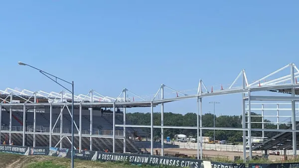
New Kansas City Stadium Offers Limited Parking
Unlike many sports arenas surrounded by seas of concrete, the new CPKC Stadium has parking for just 2,000 vehicles, hoping most sports fans will arrive by transit.
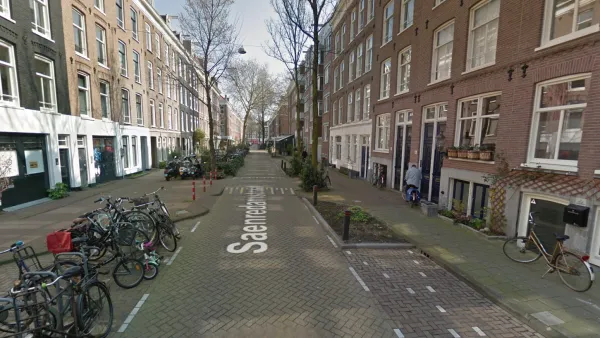
Watch: How to Remove Thousands of Parking Spaces
What the city of Amsterdam will gain by removing cars from on-street parking space.
Will ‘Worst Parking Crater’ Award Produce Policy Change?
Streetsblog doesn’t pull any punches with its “Golden Crater” award—an award for the worst parking crater in the country, selected by a March Madness style tournament. This year's winner/loser: Rochester, New York.

National Parks Layoffs Will Cause Communities to Lose Billions
Thousands of essential park workers were laid off this week, just before the busy spring break season.

Retro-silient?: America’s First “Eco-burb,” The Woodlands Turns 50
A master-planned community north of Houston offers lessons on green infrastructure and resilient design, but falls short of its founder’s lofty affordability and walkability goals.

Delivering for America Plan Will Downgrade Mail Service in at Least 49.5 Percent of Zip Codes
Republican and Democrat lawmakers criticize the plan for its disproportionate negative impact on rural communities.

Test News Post 1
This is a summary

Test News Headline 46
Test for the image on the front page.

Balancing Bombs and Butterflies: How the National Guard Protects a Rare Species
The National Guard at Fort Indiantown Gap uses GIS technology and land management strategies to balance military training with conservation efforts, ensuring the survival of the rare eastern regal fritillary butterfly.
Urban Design for Planners 1: Software Tools
This six-course series explores essential urban design concepts using open source software and equips planners with the tools they need to participate fully in the urban design process.
Planning for Universal Design
Learn the tools for implementing Universal Design in planning regulations.
EMC Planning Group, Inc.
Planetizen
Planetizen
Mpact (formerly Rail~Volution)
Great Falls Development Authority, Inc.
HUDs Office of Policy Development and Research
NYU Wagner Graduate School of Public Service