


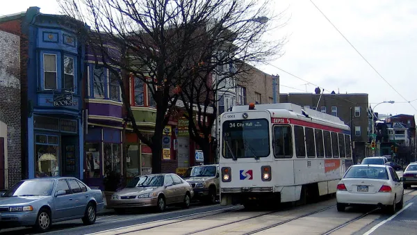
A report from the Brookings Institution shows how planners can use new types of anonymized data to inform mobility planning decisions.

A recently published Brookings Institution report, titled "Connecting people and places: Exploring new measures of travel behavior," uses data derived from geolocation sources to analyze information about patterns of travel in six U.S. metropolitan areas.
Thanks to such sources as cell phone data and shared bike platforms, planners now have access to data that could be used to shed light on mobility, reports Bill Lucia. The researchers responsible for the Brookings report assert that the use of this data in planning practice is not only beneficial on the individual level, but also to society at large.
Lucia writes:
The ideas raised in the report tie back to longstanding, and sometimes contentious, policy issues in areas like housing affordability, racial and income inequality, transit, and the legacy of how America has built and reworked cities and suburbs over decades of time.
But the way the researchers tap into the geolocation data to provide a foundation for their analysis underscores how state and local agencies might use this type of information in similar ways to inform policy decisions and discussions surrounding these issues.
The data used in the report was collected and anonymized by the company Replica. Researchers at the Brookings Institution's Metropolitan Policy Program fellow Adie Tomer is quoted in the article saying that the research reveals the power of location data to inform new choices for mobility planning.
FULL STORY: Geolocation Data Could Help Planners Design Communities that Require Less Driving


A Compact, Connected, Clean, and Inclusive Recovery for Mexico
As the Mexican government charts the country’s recovery from COVID-19, a newly published paper charts national solutions to urban transportation and housing challenges that will put Mexico’s cities on a path to prosperity and resilience.

Austin Strategic Mobility Plan Final Draft Released
The first priority of the draft Austin Strategic Mobility Plan is to reduce single-occupant vehicle trips.
Philadelphia's First Strategic Transportation Plan Released
Getting serious about mobility and traffic safety in the City of Brotherly Love.

National Parks Layoffs Will Cause Communities to Lose Billions
Thousands of essential park workers were laid off this week, just before the busy spring break season.

Retro-silient?: America’s First “Eco-burb,” The Woodlands Turns 50
A master-planned community north of Houston offers lessons on green infrastructure and resilient design, but falls short of its founder’s lofty affordability and walkability goals.

Delivering for America Plan Will Downgrade Mail Service in at Least 49.5 Percent of Zip Codes
Republican and Democrat lawmakers criticize the plan for its disproportionate negative impact on rural communities.

Test News Post 1
This is a summary

Test News Headline 46
Test for the image on the front page.

Balancing Bombs and Butterflies: How the National Guard Protects a Rare Species
The National Guard at Fort Indiantown Gap uses GIS technology and land management strategies to balance military training with conservation efforts, ensuring the survival of the rare eastern regal fritillary butterfly.
Urban Design for Planners 1: Software Tools
This six-course series explores essential urban design concepts using open source software and equips planners with the tools they need to participate fully in the urban design process.
Planning for Universal Design
Learn the tools for implementing Universal Design in planning regulations.
EMC Planning Group, Inc.
Planetizen
Planetizen
Mpact (formerly Rail~Volution)
Great Falls Development Authority, Inc.
HUDs Office of Policy Development and Research
NYU Wagner Graduate School of Public Service