


The New York Department of Transportation is changing the way it plans and manages open streets as political support for the concept wavers.
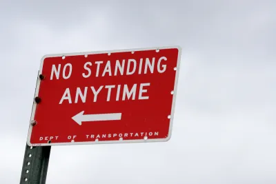
"The [New York City] Department of Transportation has abruptly scuttled the Upper West Side’s only north-south open street," according to an article by Streetsblog New York City. The story about the nine-block stretch of West End Avenue between 87th and 96th streets is indicative of the city's recent retreat from car-free ambitions that gained political will and public momentum in the city during the pandemic.
According to the article, Upper West Side residents and organizations are being told by the NYCDOT that community groups will be necessary to "manage" and "enforce" new open streets.
Here's how the article describes the open street back in its heyday:
During the spring and early summer, when many Upper West Siders fleeing the city, the West End Avenue open street offered residents a quieter neighborhood, low traffic, a slower pace and, most important, a safe place to get outside at a proper distance. Some residents pulled out lawn chairs; others taught their kids to ride bikes. One doorman led the neighbors in nightly 7 p.m. “whoop” for essential workers.
That was before. In recent months, according to the article, the street started filling up with cars again—creating conflicts that have been materializing in New York City with greater frequency in recent weeks. The political power of car-centric use of public space has also been evident in the city's slow rollout of a bus priority program announced in June.
Based on the report, the decision to end the West End Avenue open street isn't the result of a push by the city to improve community buy-in, similar to steps taken to address equity in open streets planning during the pandemic in Oakland, California. In New York City, the political cause is traced to a specific "pro-parking, pro-driving agitator."
FULL STORY: ANATOMY OF A DEBACLE: DOT Eliminates Open Street on West End Avenue

Open Streets and Outdoor Dining Are Best for Business, Report Says
Most business owners believe that they'd be out of business without on-street parking near their front door. The experience of New York City during the pandemic proves otherwise.
The Tide Has Turned Against Open Streets
Once a promising development for advocates pushing for a less car-centric future in cities, the open streets movement has ceded significant ground to cars since the height of the pandemic.
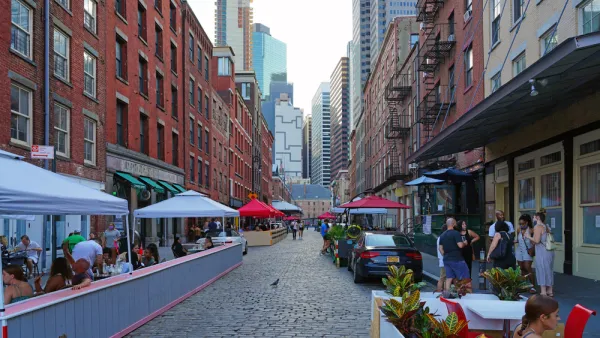
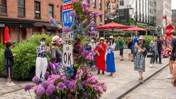
Permanent Car-Free Streets in Manhattan's Meatpacking District
The local Business Improvement District has decided to permanently block cars from a large swath of Manhattan's Meatpacking District.

National Parks Layoffs Will Cause Communities to Lose Billions
Thousands of essential park workers were laid off this week, just before the busy spring break season.

Retro-silient?: America’s First “Eco-burb,” The Woodlands Turns 50
A master-planned community north of Houston offers lessons on green infrastructure and resilient design, but falls short of its founder’s lofty affordability and walkability goals.

Delivering for America Plan Will Downgrade Mail Service in at Least 49.5 Percent of Zip Codes
Republican and Democrat lawmakers criticize the plan for its disproportionate negative impact on rural communities.

Test News Post 1
This is a summary

Test News Headline 46
Test for the image on the front page.

Balancing Bombs and Butterflies: How the National Guard Protects a Rare Species
The National Guard at Fort Indiantown Gap uses GIS technology and land management strategies to balance military training with conservation efforts, ensuring the survival of the rare eastern regal fritillary butterfly.
Urban Design for Planners 1: Software Tools
This six-course series explores essential urban design concepts using open source software and equips planners with the tools they need to participate fully in the urban design process.
Planning for Universal Design
Learn the tools for implementing Universal Design in planning regulations.
EMC Planning Group, Inc.
Planetizen
Planetizen
Mpact (formerly Rail~Volution)
Great Falls Development Authority, Inc.
HUDs Office of Policy Development and Research
NYU Wagner Graduate School of Public Service