


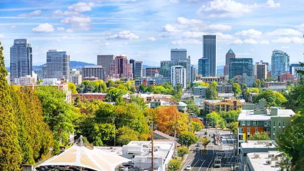
Google has unveiled a new tool called Tree Canopy Lab in an effort to keep cities like Los Angeles cool by helping them to know where to plant more trees.

Many of us would probably agree that planting more trees is a good thing. Cities tend to be warmer than surrounding areas because buildings and asphalt trap heat, resulting in the urban heat island effect. One way to cool urban areas down is to plant more trees in neighborhoods where they are sparse.
The challenge is knowing where to plant trees strategically to benefit those who need them most. As Justine Calma explains in this article, Google has released a tool that can help. Specifically, Google's new Tree Canopy Lab can help cities keep their residents cool by mapping out where trees are needed most.
Tree Canopy Lab uses aerial imagery and Google’s artificial intelligence to figure out where every tree is in a city. The tool then puts that information on an interactive map along with additional data layers on which neighborhoods are more densely populated and are more vulnerable to high temperatures. The idea is that planting new trees in these areas can help cities adapt to a warming world and save lives during heat waves.
Google piloted Tree Canopy Lab in Los Angeles. Data on hundreds more cities is on the way. Tree Canopy Lab found that over half of L.A. residents live in places where trees shade less than 10 percent of their neighborhood. It also found that 44 percent of Angelenos live in places with extreme heat risk. Heat waves in Los Angeles County have gotten longer, more frequent, and more intense over the past 50 years.
FULL STORY: Google launches new tool to help cities stay cool


Improving South Los Angeles Through Strategic Tree Planting
The University of Southern California Urban Trees Initiative is planting 250 trees in South L.A. neighborhoods to improve shade, combat climate change, and enhance community well-being through collaboration and data-driven approaches.
Invasive Beetles Put Oregon Forests at Risk
Two recently discovered borer beetles could lead to a significant loss of tree canopy.

The Problem with Tree Planting Programs
Ambitious campaigns to plant trees in urban areas often don't take into account the complexities of growing and maintaining effective urban forests.

National Parks Layoffs Will Cause Communities to Lose Billions
Thousands of essential park workers were laid off this week, just before the busy spring break season.

Retro-silient?: America’s First “Eco-burb,” The Woodlands Turns 50
A master-planned community north of Houston offers lessons on green infrastructure and resilient design, but falls short of its founder’s lofty affordability and walkability goals.

Delivering for America Plan Will Downgrade Mail Service in at Least 49.5 Percent of Zip Codes
Republican and Democrat lawmakers criticize the plan for its disproportionate negative impact on rural communities.

Test News Post 1
This is a summary

Test News Headline 46
Test for the image on the front page.

Balancing Bombs and Butterflies: How the National Guard Protects a Rare Species
The National Guard at Fort Indiantown Gap uses GIS technology and land management strategies to balance military training with conservation efforts, ensuring the survival of the rare eastern regal fritillary butterfly.
Urban Design for Planners 1: Software Tools
This six-course series explores essential urban design concepts using open source software and equips planners with the tools they need to participate fully in the urban design process.
Planning for Universal Design
Learn the tools for implementing Universal Design in planning regulations.
EMC Planning Group, Inc.
Planetizen
Planetizen
Mpact (formerly Rail~Volution)
Great Falls Development Authority, Inc.
HUDs Office of Policy Development and Research
NYU Wagner Graduate School of Public Service