


The Los Angeles County Board of Supervisors recently closed outdoor dining because of a sudden but rapid rise of coronavirus infections in the county.
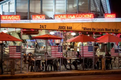
After the L.A. County Department of Health's order to shut down outdoor on-site dining facilities, restaurant owners and other food service workers want to know why their service is under fire while retail and gyms are allowed to stay open at a reduced capacity.
What data did the county Board of Supervisors consult when making this decision? Farley Elliott says that Los Angeles County, despite having a "fairly robust" contract-tracing program, has gathered data that are far from exhaustive and clean. The County has faced great difficulty in tracking cases with "10 million inhabitants, 31,000 restaurants, few mechanisms currently in place to limit individual travel, and no mandate to collect customer data at restaurants or points of retail," writes Elliott.
According to county officials, it is estimated that up to 15% of COVID cases can be traced to "dining experience," Elliott reports. UCLA associate professor of community health sciences and epidemiology Shira Shafir indicates that according to the contact tracking data, outdoor dining could contribute to the spread of the virus. Officials point to risk in any activity that requires people to gather, and especially those that require the removal of face coverings.
Elliot says that the county Board of Supervisors' decision to close outdoor dining has nothing to do with the causal data connecting specific activities to the spread of the virus. "Simply put, county officials agreed to shut down outdoor dining because coronavirus cases and hospitalizations have been rising dramatically over several weeks, and reducing the number of places where people gather — especially unmasked — is one of the levers of power available to them," opines Elliot.
FULL STORY: Where Is the Data to Support Closing Outdoor Dining in LA? It’s Complicated


Los Angeles Extends Outdoor Dining Program for Up to Three Years
An emergency ordinance signed by the city's mayor will allow restaurants to keep outdoor dining facilities built during the pandemic for at least one more year.

Winter Is Coming—Capitalize on It
Outdoor dining programs have provided relief for local restaurants and retailers, while offering an oasis of social life for residents. The winter months will challenge that momentum, but creative, flexible approaches can save the day again.

Seattle Extends Outdoor Dining for a Year, Eases Rules on Heaters for the Winter
Outdoor dining is going to hang out for a bit.

National Parks Layoffs Will Cause Communities to Lose Billions
Thousands of essential park workers were laid off this week, just before the busy spring break season.

Retro-silient?: America’s First “Eco-burb,” The Woodlands Turns 50
A master-planned community north of Houston offers lessons on green infrastructure and resilient design, but falls short of its founder’s lofty affordability and walkability goals.

Delivering for America Plan Will Downgrade Mail Service in at Least 49.5 Percent of Zip Codes
Republican and Democrat lawmakers criticize the plan for its disproportionate negative impact on rural communities.

Test News Post 1
This is a summary

Test News Headline 46
Test for the image on the front page.

Balancing Bombs and Butterflies: How the National Guard Protects a Rare Species
The National Guard at Fort Indiantown Gap uses GIS technology and land management strategies to balance military training with conservation efforts, ensuring the survival of the rare eastern regal fritillary butterfly.
Urban Design for Planners 1: Software Tools
This six-course series explores essential urban design concepts using open source software and equips planners with the tools they need to participate fully in the urban design process.
Planning for Universal Design
Learn the tools for implementing Universal Design in planning regulations.
EMC Planning Group, Inc.
Planetizen
Planetizen
Mpact (formerly Rail~Volution)
Great Falls Development Authority, Inc.
HUDs Office of Policy Development and Research
NYU Wagner Graduate School of Public Service