


The new National Risk Index calculates the brutal equations of natural disasters.
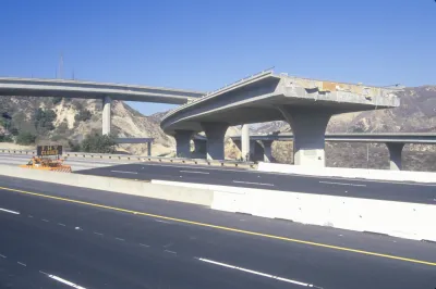
Seth Borenstein shares news of the latest National Risk Index, published by the Federal Emergency Management Agency. The Index calculates the risks facing every county in the United States due to natural disasters—earthquakes, hurricanes, tornadoes, floods, and the like.
Los Angeles County tops the Index, which calculates risk based on how many people and how much property is harm's way in places prone to natural disasters. The people and property components reveals a few potential surprises in the Index, as detailed by Borenstein in the source article.
FULL STORY: Watch out LA: Feds calculate riskiest, safest places in US


Five Years of 100 Resilient Cities
It's been five years since the Rockefeller Foundation launched the 100 Resilient Cities initiative. A new analysis by the Urban Institute evaluates the accomplishments of 100 Resilient Cities so far.
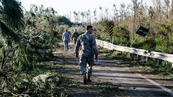
The Price of Natural Disasters
Worldwide, natural disasters cost $155 billion in 2018, according to an insurance industry report.
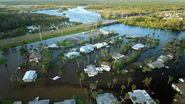
Research Shows White Communities Gain Affluence After Climate Disasters
People of color and lower-income residents tend to lose wealth despite the stated goals of federal assistance programs to restore communities impacted by disasters.

Analysis: Cybertruck Fatality Rate Far Exceeds That of Ford Pinto
The Tesla Cybertruck was recalled seven times last year.

National Parks Layoffs Will Cause Communities to Lose Billions
Thousands of essential park workers were laid off this week, just before the busy spring break season.

Retro-silient?: America’s First “Eco-burb,” The Woodlands Turns 50
A master-planned community north of Houston offers lessons on green infrastructure and resilient design, but falls short of its founder’s lofty affordability and walkability goals.

Test News Post 1
This is a summary

Analysis: Cybertruck Fatality Rate Far Exceeds That of Ford Pinto
The Tesla Cybertruck was recalled seven times last year.

Test News Headline 46
Test for the image on the front page.
Urban Design for Planners 1: Software Tools
This six-course series explores essential urban design concepts using open source software and equips planners with the tools they need to participate fully in the urban design process.
Planning for Universal Design
Learn the tools for implementing Universal Design in planning regulations.
EMC Planning Group, Inc.
Planetizen
Planetizen
Mpact (formerly Rail~Volution)
Great Falls Development Authority, Inc.
HUDs Office of Policy Development and Research
NYU Wagner Graduate School of Public Service