


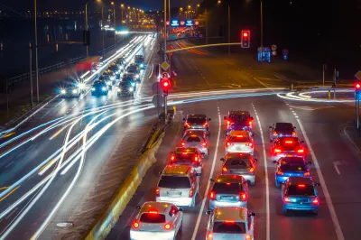
The map of metropolitan areas that drive least, and thus emit fewer greenhouse gas emissions, has been completely redrawn by the pandemic, according to a recent report.
Kristin Musulin reports:
StreetLight Data has released its 2020 U.S. Transportation Climate Impact Index, which ranks the nation's 100 most populous metro areas on vehicle miles traveled (VMT), mileage of bike and pedestrian commuting, per-capita transit use, population density and circuity.
This year's reports reflects a major shakeup from the 2019 list, thanks to the wild shifts in transportation patterns due to public health restrictions and the resulting economic fallout during the pandemic. Only two cities, San Francisco and New York, appear on both the 2020 and the 2019 list according to Musulin.
"StreetLight Data recognized the COVID-19 pandemic has had an 'unprecedented impact' on vehicle miles traveled (VMT) nationally, which in turn impacted the rankings," writes Musulin.
Overall, VMT is still down compared to pre-pandemic times, continuing a trend identified in a report released by StreetLight Data this summer.
Phaedra Hise, StreetLight Data's director of content, is quoted in the article adding the caveat that it is too soon to tell whether these changes will be permanent, but the pandemic travel data does reveal some hope that localities can decouple VMT from economic growth (measured by GDP).
FULL STORY: COVID ushers new cities to top of VMT climate index

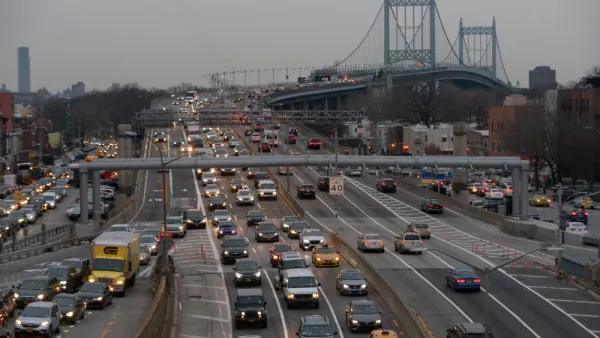
Report: Vehicle Miles Traveled Almost Fully Returned to Pre-Pandemic Levels
Reports last week that the U.S. economy is about 30 percent smaller than before the pandemic aren't reflected in driving trends.
Greenhouse Gas Emissions Reduced 17% Worldwide in April, Study Says
A recently published study predicts a 4 to 7 percent decline in greenhouse gas emissions for 2020 compared to 2019.

Ranking the Climate Impact of Transportation in the 100 Largest U.S. Metro Areas
This performance ranking separates the fakers from the legit operation to reduce carbon emissions from transportation.

National Parks Layoffs Will Cause Communities to Lose Billions
Thousands of essential park workers were laid off this week, just before the busy spring break season.

Retro-silient?: America’s First “Eco-burb,” The Woodlands Turns 50
A master-planned community north of Houston offers lessons on green infrastructure and resilient design, but falls short of its founder’s lofty affordability and walkability goals.

Delivering for America Plan Will Downgrade Mail Service in at Least 49.5 Percent of Zip Codes
Republican and Democrat lawmakers criticize the plan for its disproportionate negative impact on rural communities.

Test News Post 1
This is a summary

Test News Headline 46
Test for the image on the front page.

Balancing Bombs and Butterflies: How the National Guard Protects a Rare Species
The National Guard at Fort Indiantown Gap uses GIS technology and land management strategies to balance military training with conservation efforts, ensuring the survival of the rare eastern regal fritillary butterfly.
Urban Design for Planners 1: Software Tools
This six-course series explores essential urban design concepts using open source software and equips planners with the tools they need to participate fully in the urban design process.
Planning for Universal Design
Learn the tools for implementing Universal Design in planning regulations.
EMC Planning Group, Inc.
Planetizen
Planetizen
Mpact (formerly Rail~Volution)
Great Falls Development Authority, Inc.
HUDs Office of Policy Development and Research
NYU Wagner Graduate School of Public Service