


Advocates want to see a safer plan for the proposed two-way path on one of the country's busiest commuter corridors.
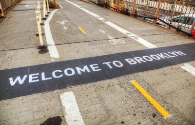
The bike path proposed for the Brooklyn Bridge by New York Department of Transportation (NYDOT) engineers, writes Alissa Walker in Curbed, is "four feet wide in each direction, which is just barely enough for two pairs of handlebars abreast." And while "any dedicated bike path on the bridge that’s clawed back from traffic is a big improvement," Walker writes that the NYDOT's plan "is not nearly ambitious enough for a crossing on what’s arguably one of the most famous bridges in the world in a city with the largest bike-share system outside of China." NACTO's urban bikeway design guide recommends a 12-foot width for two-way cycleways, and the "convoluted meander of connecting paths at either side of the bridge" creates "a reliable recipe for collisions and crashes."
After adding 28 miles of bikeways in the city over the past year, the half-hearted Brooklyn Bridge design just doesn't "add up," writes Walker. "In an alternate timeline, the city would have widened the promenade so people on bikes got fresh air and skyline views instead of being condemned to the car cage below. But even with an imperfect path, the bridge is certain to get even more riders." Hopefully, Walker notes, the influx of commuters will convince the city to install a wider, safer bikeway in the future.
FULL STORY: The Brooklyn Bridge Finally Gets Its Own Bike Path! Except …


Bike Traffic Up 88 Percent On New Brooklyn Bridge Bike Lane
Bike ridership nearly doubled after New York City installed a new bike lane on the Brooklyn Bridge.

The ‘Great Bike Infrastructure Project’
A new mapping project envisions a coordinated national push for bikeways.

Queensboro Bridge Bike Lane Delayed Again
A project that would give pedestrians their own dedicated path on the crowded bridge has been pushed back to at least the summer of 2024.

National Parks Layoffs Will Cause Communities to Lose Billions
Thousands of essential park workers were laid off this week, just before the busy spring break season.

Retro-silient?: America’s First “Eco-burb,” The Woodlands Turns 50
A master-planned community north of Houston offers lessons on green infrastructure and resilient design, but falls short of its founder’s lofty affordability and walkability goals.

Delivering for America Plan Will Downgrade Mail Service in at Least 49.5 Percent of Zip Codes
Republican and Democrat lawmakers criticize the plan for its disproportionate negative impact on rural communities.

Test News Post 1
This is a summary

Test News Headline 46
Test for the image on the front page.

Balancing Bombs and Butterflies: How the National Guard Protects a Rare Species
The National Guard at Fort Indiantown Gap uses GIS technology and land management strategies to balance military training with conservation efforts, ensuring the survival of the rare eastern regal fritillary butterfly.
Urban Design for Planners 1: Software Tools
This six-course series explores essential urban design concepts using open source software and equips planners with the tools they need to participate fully in the urban design process.
Planning for Universal Design
Learn the tools for implementing Universal Design in planning regulations.
EMC Planning Group, Inc.
Planetizen
Planetizen
Mpact (formerly Rail~Volution)
Great Falls Development Authority, Inc.
HUDs Office of Policy Development and Research
NYU Wagner Graduate School of Public Service