


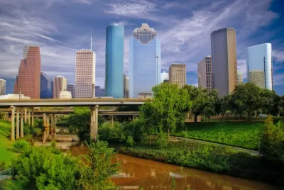
Bayou Greenways Park is part of a decade-long project building 172 miles of connected greenways around the city of Houston.
"[Y]ears of greener urban development led to this week’s opening of Bayou Greenways Park" in Houston, writes Andrew Dansby in the Houston Chronicle, adding another green spot to Houston's freeway-dominated downtown. "Bayou Greenways Park serves as a hub of sorts for Bayou Greenways 2020, a much larger, more ambitious 172-mile project that is roughly 122 miles into completion, with parks and paths around Brays, Buffalo, Greens, Halls, Hunting, Sims and White Oak Bayous, as well as the West Fork of the San Jacinto River."
Bayou Greenways "was designed to provide equitable access to park space across different parts of the city" and connect "neighborhoods via passageways that don’t require automobiles." But connecting the new greenways poses a major logistical challenge. Barron Wallace, Houston Parks Board chairman, says "getting a city to execute a plan like Bayou Greenways 2020 is like turning an aircraft carrier." Building greenways involves collaboration with stakeholders, transportation agencies, and the Harris County Flood Control District, among other entities.
"When the Bayou Greenways project is complete, it will bring an estimated 1.5 million Houstonians within 1.5 miles of green space" and open up new possibilities for Houstonians to explore and enjoy their city.
FULL STORY: Bayou Greenways Park opens this week as part of master plan for greener Houston

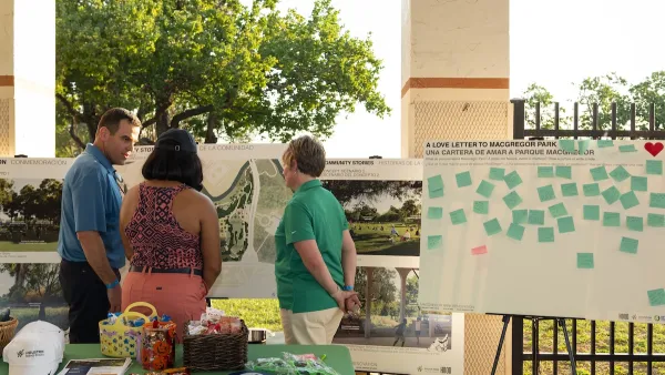
Public and Private Collaboration Advances Park Development in Houston
Houston may be known to some as a concrete jungle, but its greenspaces continue to expand thanks to combined support from the public, private, and philanthropic sectors.
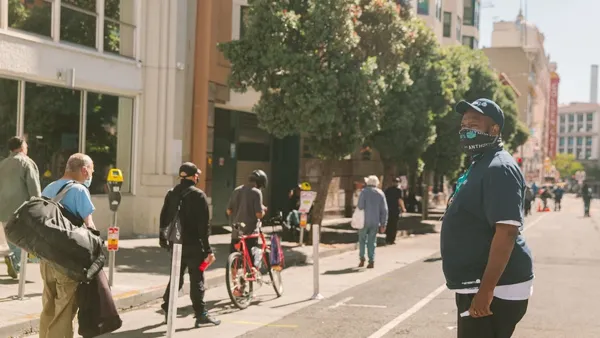
Tenderloin Greenway Closer to Reality
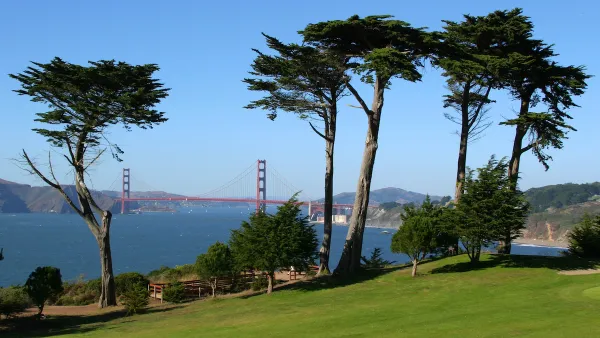
The Golden Gate Greenway will provide much-needed permanent park and community space in the dense neighborhood.
Urban Golf Courses: Publicly Subsidized, Privately Enjoyed
City golf courses, paid for by public dollars, are rarely used by the vast majority of residents. Some advocates want to see them opened to the public as parks or repurposed for housing.

Analysis: Cybertruck Fatality Rate Far Exceeds That of Ford Pinto
The Tesla Cybertruck was recalled seven times last year.

National Parks Layoffs Will Cause Communities to Lose Billions
Thousands of essential park workers were laid off this week, just before the busy spring break season.

Retro-silient?: America’s First “Eco-burb,” The Woodlands Turns 50
A master-planned community north of Houston offers lessons on green infrastructure and resilient design, but falls short of its founder’s lofty affordability and walkability goals.

Test News Post 1
This is a summary

Analysis: Cybertruck Fatality Rate Far Exceeds That of Ford Pinto
The Tesla Cybertruck was recalled seven times last year.

Test News Headline 46
Test for the image on the front page.
Urban Design for Planners 1: Software Tools
This six-course series explores essential urban design concepts using open source software and equips planners with the tools they need to participate fully in the urban design process.
Planning for Universal Design
Learn the tools for implementing Universal Design in planning regulations.
EMC Planning Group, Inc.
Planetizen
Planetizen
Mpact (formerly Rail~Volution)
Great Falls Development Authority, Inc.
HUDs Office of Policy Development and Research
NYU Wagner Graduate School of Public Service