


New research assesses the land value of street space in 20 of the largest counties in the United States.

"During lockdowns, cities all over the world turned residential and commercial corridors into slow (or no) vehicle zones for pedestrians, cyclists, cafe seating, parklets and play," writes Laura Bliss in Bloomberg CityLab. Our ideas about what streets could be shifted radically in many places. Yet, before the pandemic, "people rarely questioned just how much space streets take up in the first place," says UCLA urban planning professor Adam Millard-Ball.
According to Millard-Ball's recent research into 20 U.S. counties, "streets took up 18% of the total land area in these counties, ranging from 14% in Middlesex County, Massachusetts (which contains the suburbs of Boston) to 30% in Kings County, New York (which is Brooklyn)." Millard-Ball also calculated the value of this space, "estimat[ing] that the residential streets in that area would be worth $959 billion if they were instead zoned for single-family homes, based on 2019 prices."
"Despite studies that show narrow streets are actually safer for users, large widths persist as required standards in local subdivision regulations." The programs created during the pandemic show that different uses are possible, and Millard-Ball argues the space could be better put to use as housing. "Cities could also allow owners to push property lines into streets to make way for front-yard ADUs or bigger, multi-family developments. And if that’s still too tricky, they could start by legalizing overnight parking for people who sleep in their cars and vans."
FULL STORY: MapLab: The High Cost of Wide Streets


Opinion: Build Density in Palo Alto–and Lots of It
To keep up with demand and slow the astronomical rise in housing costs, Palo Alto and other Silicon Valley cities must overcome local opposition to density and high-rises.
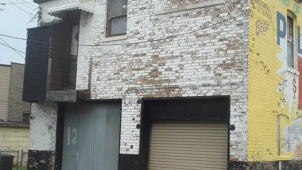
Chicago Coach Houses, Legalize 'Em
Coach houses could provide affordable housing and revenue for home owners if they were more widely permitted in the city.
The 'Missing Middle' Affordable Housing Solution
Karen Parolek discusses the 'Missing Middle' that is too often overlooked in discussions about affordable housing.

National Parks Layoffs Will Cause Communities to Lose Billions
Thousands of essential park workers were laid off this week, just before the busy spring break season.

Retro-silient?: America’s First “Eco-burb,” The Woodlands Turns 50
A master-planned community north of Houston offers lessons on green infrastructure and resilient design, but falls short of its founder’s lofty affordability and walkability goals.

Delivering for America Plan Will Downgrade Mail Service in at Least 49.5 Percent of Zip Codes
Republican and Democrat lawmakers criticize the plan for its disproportionate negative impact on rural communities.

Test News Post 1
This is a summary

Test News Headline 46
Test for the image on the front page.

Balancing Bombs and Butterflies: How the National Guard Protects a Rare Species
The National Guard at Fort Indiantown Gap uses GIS technology and land management strategies to balance military training with conservation efforts, ensuring the survival of the rare eastern regal fritillary butterfly.
Urban Design for Planners 1: Software Tools
This six-course series explores essential urban design concepts using open source software and equips planners with the tools they need to participate fully in the urban design process.
Planning for Universal Design
Learn the tools for implementing Universal Design in planning regulations.
EMC Planning Group, Inc.
Planetizen
Planetizen
Mpact (formerly Rail~Volution)
Great Falls Development Authority, Inc.
HUDs Office of Policy Development and Research
NYU Wagner Graduate School of Public Service