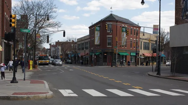
The policy is aimed at reducing the cost of building affordable housing and helping affordable housing developers to better compete on property acquisitions.

When the city of Cambridge passed its 100 Percent Affordable Housing Overlay (AHO) ordinance in October of 2020, supporters hoped it would "reduce affordable housing development costs by 10 to 15 percent per leasable square foot" and make it more possible to build affordable housing in the city. Andrew Gibbs analyzes the key provisions of the ordinance, which include a requirement that "at least 80 percent of rental dwellings (or 50 percent of for-sale dwelling units)" in a district " are dedicated to households making up to 80 percent of Area Median Income (AMI)" as well as exemptions related to height and density limits, parking requirements, and lot coverage. "The AHO removes off-street parking requirements, unless needed to conform to other laws," eliminating the need to build costly parking, which costs $25,752 per surface parking space in the Boston metro area.
"The AHO gives property owners the 'as-of-right' ability to develop affordable housing in Cambridge," a measure designed to "reduce execution risks and give lenders more confidence to provide land acquisition and pre-construction loans." Though the exact potential impacts are hard to quantify, the new provisions "should help affordable developers make competitive offers for developable land in Cambridge" and, if the reduction in development costs holds true at 10 to 15 percent, "the effect of the AHO should be an equivalent increase in affordable housing units built each year." While the AHO will not entirely solve Cambridge's housing issues, "the AHO has the potential to add a material number of new affordable homes and set a new industry standard for cities using comprehensive zoning tools alleviate affordability burdens."
FULL STORY: WHAT CAN WE EXPECT FROM CAMBRIDGE’S NEW AFFORDABLE HOUSING OVERLAY?

National Parks Layoffs Will Cause Communities to Lose Billions
Thousands of essential park workers were laid off this week, just before the busy spring break season.

Retro-silient?: America’s First “Eco-burb,” The Woodlands Turns 50
A master-planned community north of Houston offers lessons on green infrastructure and resilient design, but falls short of its founder’s lofty affordability and walkability goals.

Delivering for America Plan Will Downgrade Mail Service in at Least 49.5 Percent of Zip Codes
Republican and Democrat lawmakers criticize the plan for its disproportionate negative impact on rural communities.

Test News Post 1
This is a summary

Test News Headline 46
Test for the image on the front page.

Balancing Bombs and Butterflies: How the National Guard Protects a Rare Species
The National Guard at Fort Indiantown Gap uses GIS technology and land management strategies to balance military training with conservation efforts, ensuring the survival of the rare eastern regal fritillary butterfly.
Urban Design for Planners 1: Software Tools
This six-course series explores essential urban design concepts using open source software and equips planners with the tools they need to participate fully in the urban design process.
Planning for Universal Design
Learn the tools for implementing Universal Design in planning regulations.
EMC Planning Group, Inc.
Planetizen
Planetizen
Mpact (formerly Rail~Volution)
Great Falls Development Authority, Inc.
HUDs Office of Policy Development and Research
NYU Wagner Graduate School of Public Service


