


New research shows a 24% increase in people living in flood-prone areas since 2000, prompting calls for increased adaptation measures.
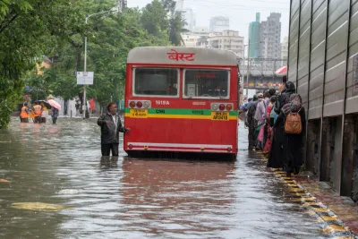
As urban centers around the world grow, sea levels rise, and extreme weather becomes more common, "the proportion of the world’s population living in flood zones has increased exponentially," writes Linda Poon. According to new research published in the journal Nature, "[f]rom 2000 to 2015, the number of people living in flood-prone areas increased by an estimated 58 million to 86 million," a 24% increase.
"The study uses a trove of satellite imagery to map 913 major flood events since 2000, which the flood monitoring startup Cloud to Street says offers planners a more detailed scope than flood projection models of the crisis facing cities." The resulting maps "combine flooding imagery with global human settlement data to show population growth in flooded areas, which the researchers attribute to increased economic development and migration to flood zones."
"Nearly 90% of the floods analyzed occurred in South and Southeast Asia, with high flood exposure in areas that have large river basins and that saw large population growth, like Dhaka and Bangladesh. In 32 countries across four continents, the population exposed to flood is increasing at a rate higher than total population growth, with India and some countries in Africa experiencing particularly large increases in flood exposure."
Flooding also poses a risk to basic infrastructure. "From the recent flooding of New York City’s nearly 120-year-old subway to Zhengzhou’s metro system in China’s Henan province, much of the urban infrastructure built decades ago is not designed to handle the kind of historic rainfall that cities often see today."
The researchers are making the database public "to help policymakers improve the accuracy of global flood risk models, which can be rife with uncertainties," and "improve the quality of vulnerability assessments, which in turn can increase the efficacy of climate adaptation measures."
FULL STORY: More People Live in Flood Zones Than Previously Thought

As Development in Flood-Prone Areas Continues, Cities Are Slow to Respond
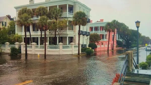
Drawn by affordable property, low taxes, and job opportunities, high numbers of Americans continue to move to flood-prone areas even as the threat of catastrophic flooding grows.

Rising Above: Innovative Solutions for Waikīkī’s Sea-Level Challenges
The University of Hawaiʻi at Mānoa’s award-winning Waikīkī sea-level rise adaptation project combines science, architecture, and community input to create scalable solutions for climate resilience and coastal flood mitigation.
How US Cities Can Prepare for Climate Disasters
Resilience, encompassing infrastructure, governance, economic strength, and social cohesion, is critical for cities to mitigate rising climate risks like flooding, wildfires, and heat, ensuring long-term recovery and adaptability.

National Parks Layoffs Will Cause Communities to Lose Billions
Thousands of essential park workers were laid off this week, just before the busy spring break season.

Retro-silient?: America’s First “Eco-burb,” The Woodlands Turns 50
A master-planned community north of Houston offers lessons on green infrastructure and resilient design, but falls short of its founder’s lofty affordability and walkability goals.

Delivering for America Plan Will Downgrade Mail Service in at Least 49.5 Percent of Zip Codes
Republican and Democrat lawmakers criticize the plan for its disproportionate negative impact on rural communities.

Test News Post 1
This is a summary

Test News Headline 46
Test for the image on the front page.

Balancing Bombs and Butterflies: How the National Guard Protects a Rare Species
The National Guard at Fort Indiantown Gap uses GIS technology and land management strategies to balance military training with conservation efforts, ensuring the survival of the rare eastern regal fritillary butterfly.
Urban Design for Planners 1: Software Tools
This six-course series explores essential urban design concepts using open source software and equips planners with the tools they need to participate fully in the urban design process.
Planning for Universal Design
Learn the tools for implementing Universal Design in planning regulations.
EMC Planning Group, Inc.
Planetizen
Planetizen
Mpact (formerly Rail~Volution)
Great Falls Development Authority, Inc.
HUDs Office of Policy Development and Research
NYU Wagner Graduate School of Public Service