


Two ramps that have minimal impact on traffic could make way for apartments, commercial spaces, or much-needed parks.
.jpg)
Bill Lindeke argues that "a pair of one-lane viaducts looming in the middle of a lovely neighborhood, blotting out the sun atop massive concrete pillars surrounded by surface parking" have no place in their otherwise "thriving, cosmopolitan part of downtown" Minneapolis. According to Lindeke, the ramps likely "do more harm than good," saving about 15,000 drivers per day "maybe two minutes of travel time, and that’s if you are being very generous with route mapping." Meanwhile, the "marginally useful" ramps are surrounded by "some of the hottest real estate in the country."
"Back in the 1950s, building urban freeways through the downtown core seemed like a good idea with few drawbacks. But now, when downtowns are adding tens of thousands of new residents, it might be time to shift urban planning priorities." With freeway removal projects "becoming a hot trend" around the country, Lindeke argues the North Loop is an ideal candidate. "Based on the property tax receipts of the adjacent block, the land underneath the viaducts is worth at least $5 million of property tax revenue annually" and could be developed into housing, offices, and parks. "This example is as clear-cut a case as you’ll find in Minnesota of addition by subtraction, taking out an unneeded section of freeway, improving the downtown economy, and greening one of the city’s thriving neighborhoods."

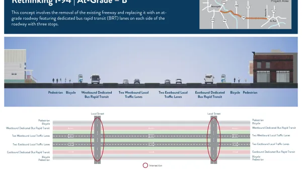
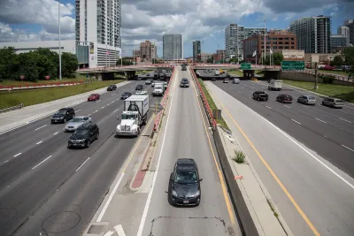
More Options Presented for Minneapolis I-94 Project
Two new proposals for replacing the freeway with at-grade segments offer new visions for the future of downtown Minneapolis.

Looking Back on 60 Years of Land Development in the Twin Cities
In 1960, about 12 percent of the Twin Cities metro's land was already developed. By 2020, about 34 percent had been developed. Many factors influenced how the region has changed since 1960.
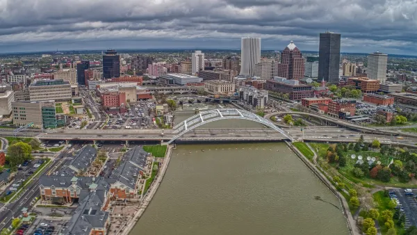
Rochester Shows Possible Future for Former Highways
A former freeway is undergoing a massive redevelopment that goes beyond highway removal to reconnect and revitalize surrounding areas.

National Parks Layoffs Will Cause Communities to Lose Billions
Thousands of essential park workers were laid off this week, just before the busy spring break season.

Retro-silient?: America’s First “Eco-burb,” The Woodlands Turns 50
A master-planned community north of Houston offers lessons on green infrastructure and resilient design, but falls short of its founder’s lofty affordability and walkability goals.

Delivering for America Plan Will Downgrade Mail Service in at Least 49.5 Percent of Zip Codes
Republican and Democrat lawmakers criticize the plan for its disproportionate negative impact on rural communities.

Test News Post 1
This is a summary

Test News Headline 46
Test for the image on the front page.

Balancing Bombs and Butterflies: How the National Guard Protects a Rare Species
The National Guard at Fort Indiantown Gap uses GIS technology and land management strategies to balance military training with conservation efforts, ensuring the survival of the rare eastern regal fritillary butterfly.
Urban Design for Planners 1: Software Tools
This six-course series explores essential urban design concepts using open source software and equips planners with the tools they need to participate fully in the urban design process.
Planning for Universal Design
Learn the tools for implementing Universal Design in planning regulations.
EMC Planning Group, Inc.
Planetizen
Planetizen
Mpact (formerly Rail~Volution)
Great Falls Development Authority, Inc.
HUDs Office of Policy Development and Research
NYU Wagner Graduate School of Public Service