


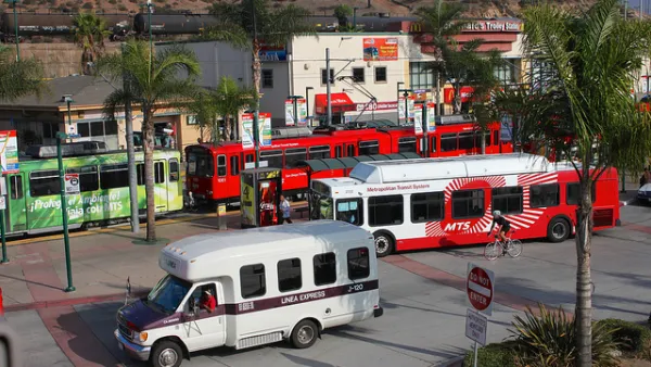
Transit advocates say that outdated road widening plans contradict the city's Climate Action Plan.

Despite the city's stated commitment "to cut back on car dependence by making streets safer and more oriented towards pedestrians, cyclists, and public transit" San Diego continues to widen roads based on outdated plans, reports Andrew Bowen.
One of the city's deadliest streets, El Cajon Boulevard, is slated to receive a new right-turn lane that would also shrink the footprint of the adjacent Fair@44 pedestrian plaza. Meanwhile, the permit for a trolley extension on Morena Boulevard required the re-widening of the street, creating dangerous conditions for pedestrians trying to reach the trolley station. Pedestrian and transit advocates say these and similar projects go against the city's 2015 Climate Action Plan, "which legally binds the city to cut back on driving by prioritizing less polluting modes of transportation."
"A lot of cities, including San Diego, haven't caught up to the value statements that their elected officials have signed onto," says Colin Parent, executive director of the nonprofit think tank Circulate San Diego. "Parent added that the city had to find a balance between redoing its old plans while not letting that work delay important projects like the trolley extension through Bay Park or the affordable housing project on El Cajon Boulevard."
FULL STORY: San Diego Pledged To Shift Away From Cars. So Why Is It Still Widening Roads?

Report: San Diego Transportation Plan Won't Meet Climate Goals
A regional plan announced by the San Diego Association of Governments will fall short of the city's goals to increase alternate mode trips to 50 percent, report finds.

San Diego Region Developing Long-Range Transportation Plan
The new plan, set to take effect in 2025, accounts for changes in mobility patterns brought on by remote work.
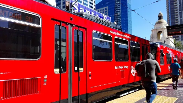
San Diego Trolley Nation’s Most Popular Light Rail
The system's ridership benefited from an extension project and free transit for youth.

National Parks Layoffs Will Cause Communities to Lose Billions
Thousands of essential park workers were laid off this week, just before the busy spring break season.

Retro-silient?: America’s First “Eco-burb,” The Woodlands Turns 50
A master-planned community north of Houston offers lessons on green infrastructure and resilient design, but falls short of its founder’s lofty affordability and walkability goals.

Delivering for America Plan Will Downgrade Mail Service in at Least 49.5 Percent of Zip Codes
Republican and Democrat lawmakers criticize the plan for its disproportionate negative impact on rural communities.

Test News Post 1
This is a summary

Test News Headline 46
Test for the image on the front page.

Balancing Bombs and Butterflies: How the National Guard Protects a Rare Species
The National Guard at Fort Indiantown Gap uses GIS technology and land management strategies to balance military training with conservation efforts, ensuring the survival of the rare eastern regal fritillary butterfly.
Urban Design for Planners 1: Software Tools
This six-course series explores essential urban design concepts using open source software and equips planners with the tools they need to participate fully in the urban design process.
Planning for Universal Design
Learn the tools for implementing Universal Design in planning regulations.
EMC Planning Group, Inc.
Planetizen
Planetizen
Mpact (formerly Rail~Volution)
Great Falls Development Authority, Inc.
HUDs Office of Policy Development and Research
NYU Wagner Graduate School of Public Service