


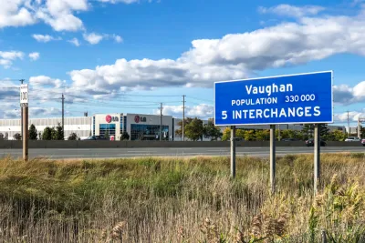
The York Regional Council took a significant step toward allowing development on a large chunk of the area's greenbelt—a move opponents say will set a dangerous precedent.
Fatime Syed reports for The Narwhal:
On Oct. 28, York Regional Council — the political body that includes mayors and regional representatives of nine municipalities just north of Toronto, including Markham and Vaughan— voted 13 to 5 in favour of Regional Official Plan Amendment 7, which proposed to change the designation of 1,400 acres of Greenbelt lands from agricultural to rural.
While four mayors voted to approve the amendment, Syed reports that local councilmembers from cities represented by those mayors oppose the development of the greenbelt. Supporting the amendment, however, are development interests with connections to Premier Doug Ford’s Progressive Conservative party. Ford ran for office on a platform that included a proposal to relax the boundaries of the Toronto Greenbelt for development.
Supporters of urban growth boundaries (another term for greenbelts) argue that the land use regulation tool is necessary as an antidote to sprawl. Opponents say fringe development can provide relief to expensive housing markets. In recent years, urban growth boundaries have emerged as a wildfire risk mitigation tool in cities located at the wildland-urban interface.
The Ontario Ministry of Municipal Affairs and Housing must still approve the amendment before it can take effect, reports Syed.
FULL STORY: In Ontario’s York Region, council just voted to allow development on 1,400 acres of Greenbelt farmland

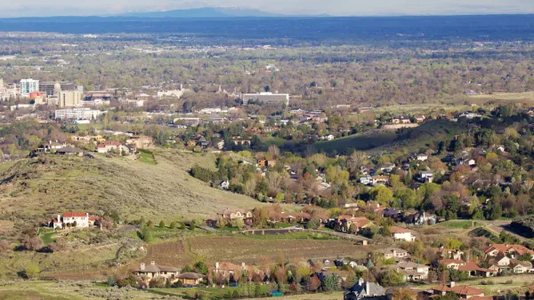
Different Approaches to Fast Growth in Idaho's Treasure Valley
Three cities on the periphery of the fast-growing Treasure Valley showcase different approaches to a sudden influx of newcomers.
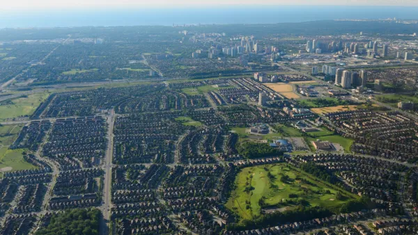
Nowhere to Build but Up
An old way of doing municipal business—generating development fees by opening farmland to development—is no longer paying dividends. Mississauga, Ontario serves as a cautionary tale for the bottom line of sprawl.
Urban Growth Boundaries Gone Awry: Protection Without Infill
Joe Mathews of Zócalo Public Square views with a great deal of skepticism the urban growth boundaries the voters of Ventura County adjacent to Los Angeles County have enacted since 1995 due to the lack of infill. Another measure is on the ballot.

National Parks Layoffs Will Cause Communities to Lose Billions
Thousands of essential park workers were laid off this week, just before the busy spring break season.

Retro-silient?: America’s First “Eco-burb,” The Woodlands Turns 50
A master-planned community north of Houston offers lessons on green infrastructure and resilient design, but falls short of its founder’s lofty affordability and walkability goals.

Delivering for America Plan Will Downgrade Mail Service in at Least 49.5 Percent of Zip Codes
Republican and Democrat lawmakers criticize the plan for its disproportionate negative impact on rural communities.

Test News Post 1
This is a summary

Test News Headline 46
Test for the image on the front page.

Balancing Bombs and Butterflies: How the National Guard Protects a Rare Species
The National Guard at Fort Indiantown Gap uses GIS technology and land management strategies to balance military training with conservation efforts, ensuring the survival of the rare eastern regal fritillary butterfly.
Urban Design for Planners 1: Software Tools
This six-course series explores essential urban design concepts using open source software and equips planners with the tools they need to participate fully in the urban design process.
Planning for Universal Design
Learn the tools for implementing Universal Design in planning regulations.
EMC Planning Group, Inc.
Planetizen
Planetizen
Mpact (formerly Rail~Volution)
Great Falls Development Authority, Inc.
HUDs Office of Policy Development and Research
NYU Wagner Graduate School of Public Service