


Southwestern Pennsylvania Commission awarded $1.4 million to the city of Pittsburgh to launch the Pittsburgh Pedestrian Wayfinding initiative.

"Pittsburgh was awarded a $1.4 million grant from the Southwestern Pennsylvania Commission to create The Pittsburgh Pedestrian Wayfinding, an initiative that seeks to make it easier for pedestrians to navigate Downtown, Oakland, and the North Side," reports Jason Phox for Pittsburgh CityPaper.
While recognized for high quality of life among well informed urbanists, the broader public is largely unaware of the walkability of Pittsburgh. "In 2019, a City Lab study ranked Pittsburgh ranked 11th in the country out of areas with more than 1 million people for how manageable they are to live without owning a car," reports Phox, adding, "Pittsburgh has high rates of people walking to work. Data shows nearly 11% of Pittsburghers walk to work, which is the fifth-best in the country."
Walk Raleigh is often recognized as the avant-garde of walkability programs, growing from a guerilla wayfinding project into a model copied in neighborhoods and cities all over the country.
FULL STORY: Pittsburgh wants to create a wayfinding initiative to help pedestrians navigate city better

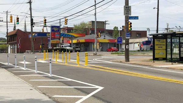
Pittsburgh Improves Road Safety With ‘Quick-Build’ Solutions
The city’s efforts to reduce crashes through traffic calming and crosswalk improvements is yielding positive results.
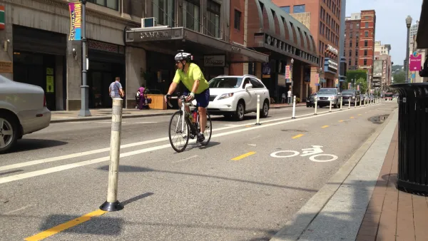
Pittsburgh Plans Pedestrian-Friendly Makeover on Downtown Street
Pittsburgh’s Smithfield Street could gain wider sidewalks, a bike lane, and more green space.

Pittsburgh Launches Pedestrian Safety Action Plan
The plan lays out strategies for improving pedestrian infrastructure and eliminating traffic deaths.

National Parks Layoffs Will Cause Communities to Lose Billions
Thousands of essential park workers were laid off this week, just before the busy spring break season.

Retro-silient?: America’s First “Eco-burb,” The Woodlands Turns 50
A master-planned community north of Houston offers lessons on green infrastructure and resilient design, but falls short of its founder’s lofty affordability and walkability goals.

Delivering for America Plan Will Downgrade Mail Service in at Least 49.5 Percent of Zip Codes
Republican and Democrat lawmakers criticize the plan for its disproportionate negative impact on rural communities.

Test News Post 1
This is a summary

Test News Headline 46
Test for the image on the front page.

Balancing Bombs and Butterflies: How the National Guard Protects a Rare Species
The National Guard at Fort Indiantown Gap uses GIS technology and land management strategies to balance military training with conservation efforts, ensuring the survival of the rare eastern regal fritillary butterfly.
Urban Design for Planners 1: Software Tools
This six-course series explores essential urban design concepts using open source software and equips planners with the tools they need to participate fully in the urban design process.
Planning for Universal Design
Learn the tools for implementing Universal Design in planning regulations.
EMC Planning Group, Inc.
Planetizen
Planetizen
Mpact (formerly Rail~Volution)
Great Falls Development Authority, Inc.
HUDs Office of Policy Development and Research
NYU Wagner Graduate School of Public Service