


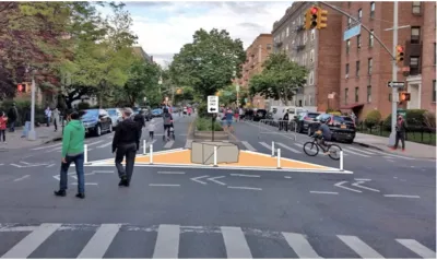
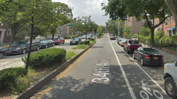
An analysis of New York's 34th Avenue shows substantial reductions in crashes and injuries, strengthening the body of evidence supporting car-free streets.
A new analysis from Streetsblog shows significant improvements in pedestrian safety on car-free streets, reports Gersh Kuntzman.
The study used data from New York City's 34th Avenue open street to compare the number of reported crashes and injuries during open streets hours (8am to 8pm), finding a sharp reduction in both. The street also saw fewer crashes and injuries during non-open streets hours, when drivers seemed more likely to avoid the street or drive more carefully due to the daytime restrictions.
Open streets advocates point to this evidence as proof that permanently banning cars from roadways could even further improve pedestrian safety. As activist Luz Maria Mercado put it, "If these are the safety results we’ve gotten from cheap barricades, imagine how safe a 24/7 linear park would be." In addition to making roads safer, open streets initiatives provide much-needed safe, open space in urban communities that frequently lack adequate park space.
But despite early promises from city officials, the proposed plan for a permanent open street on 34th Avenue would not be a true linear park, but rather a combination of car-free blocks and shared streets with diverters intended to slow drivers while maintaining vehicular access.
FULL STORY: Car-Free Streets are Simply Safer, Data Continue to Show

How Can NYC Keep its 'Open Streets' Post-Pandemic?
A debate over one Queens 'open street' project illustrates the challenges of maintaining open streets.

NYC Officials Announce Broadway Pedestrianization Project
Two blocks of the marquee street will become mostly car-free public spaces.
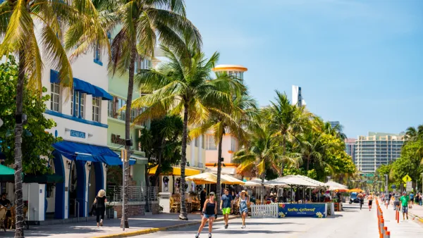
Miami Beach to Reopen Ocean Drive to Cars
The famous cruising strip was off-limits to cars during the pandemic. Now, the city is letting vehicles return with some pedestrian-oriented compromises.

National Parks Layoffs Will Cause Communities to Lose Billions
Thousands of essential park workers were laid off this week, just before the busy spring break season.

Retro-silient?: America’s First “Eco-burb,” The Woodlands Turns 50
A master-planned community north of Houston offers lessons on green infrastructure and resilient design, but falls short of its founder’s lofty affordability and walkability goals.

Delivering for America Plan Will Downgrade Mail Service in at Least 49.5 Percent of Zip Codes
Republican and Democrat lawmakers criticize the plan for its disproportionate negative impact on rural communities.

Test News Post 1
This is a summary

Test News Headline 46
Test for the image on the front page.

Balancing Bombs and Butterflies: How the National Guard Protects a Rare Species
The National Guard at Fort Indiantown Gap uses GIS technology and land management strategies to balance military training with conservation efforts, ensuring the survival of the rare eastern regal fritillary butterfly.
Urban Design for Planners 1: Software Tools
This six-course series explores essential urban design concepts using open source software and equips planners with the tools they need to participate fully in the urban design process.
Planning for Universal Design
Learn the tools for implementing Universal Design in planning regulations.
EMC Planning Group, Inc.
Planetizen
Planetizen
Mpact (formerly Rail~Volution)
Great Falls Development Authority, Inc.
HUDs Office of Policy Development and Research
NYU Wagner Graduate School of Public Service