


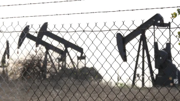
Research shows neighborhoods historically redlined by the federal government have twice as many oil and gas extraction projects as “desirable” neighborhoods.

A first-of-its-kind analysis from a research team from the University of California, Berkeley, the University of California, San Francisco, and Columbia University highlights the correlation between historical redlining and oil and gas wells in neighborhoods. As Julia Kane writes, “[The research team] compared data on the location of plugged and active oil and gas wells to data from maps generated by the Home Owners Loan Corporation, the federal lending program created to prevent home foreclosures during the Great Depression.”
Looking at data for 33 cities where oil and gas wells are drilled and operated in urban neighborhoods across 13 states, researchers discovered the striking correlation between neighborhoods that were redlined and neighborhoods that have a high density of oil and gas wells.
While the study did not establish a causal link between redlining and drilling, Kane notes, “It’s not news that redlined communities tend to experience worse health outcomes. There are also links between neighborhoods that have undergone disinvestment and neighborhoods where there are higher rates of gun violence and less green space.”
This can directly affect the health of communities living near extraction sites. “Numerous studies have found that living near oil and gas wells increases a person’s risk of cardiovascular disease, impaired lung function, anxiety, depression, preterm birth, and impaired fetal growth — serious concerns for the estimated 17 million people in the U.S. who live within a mile of at least one active well.”
FULL STORY: Historically redlined neighborhoods have twice the number of oil and gas wells

Los Angeles To Phase Out Oil Drilling
The city has banned new wells and will end all extraction within two decades.
Your Not-So-Friendly Neighborhood Oil Well
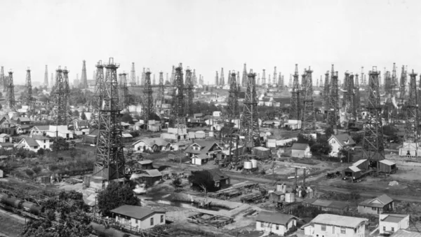
Much of California's oil and gas extraction takes place in residential neighborhoods, posing significant health risks to entire communities.

Pollution Does Discriminate in Orlando’s Parramore Neighborhood
Poor air quality has decimated the health of residents in this predominantly black community ringed by highways.

National Parks Layoffs Will Cause Communities to Lose Billions
Thousands of essential park workers were laid off this week, just before the busy spring break season.

Retro-silient?: America’s First “Eco-burb,” The Woodlands Turns 50
A master-planned community north of Houston offers lessons on green infrastructure and resilient design, but falls short of its founder’s lofty affordability and walkability goals.

Delivering for America Plan Will Downgrade Mail Service in at Least 49.5 Percent of Zip Codes
Republican and Democrat lawmakers criticize the plan for its disproportionate negative impact on rural communities.

Test News Post 1
This is a summary

Test News Headline 46
Test for the image on the front page.

Balancing Bombs and Butterflies: How the National Guard Protects a Rare Species
The National Guard at Fort Indiantown Gap uses GIS technology and land management strategies to balance military training with conservation efforts, ensuring the survival of the rare eastern regal fritillary butterfly.
Urban Design for Planners 1: Software Tools
This six-course series explores essential urban design concepts using open source software and equips planners with the tools they need to participate fully in the urban design process.
Planning for Universal Design
Learn the tools for implementing Universal Design in planning regulations.
EMC Planning Group, Inc.
Planetizen
Planetizen
Mpact (formerly Rail~Volution)
Great Falls Development Authority, Inc.
HUDs Office of Policy Development and Research
NYU Wagner Graduate School of Public Service