


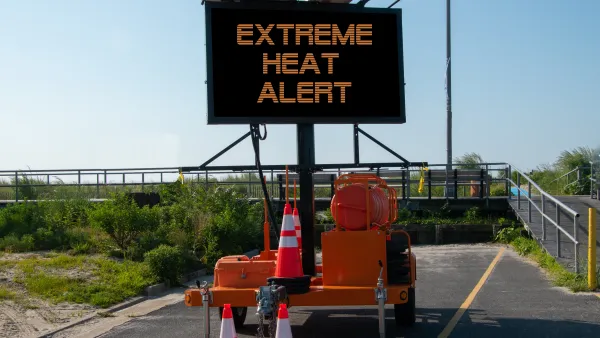
A new mapping tool underscores inequities in infrastructure that lead to higher rates of heat-related illnesses in low-income neighborhoods.

A new mapping tool from UCLA that tracks heat-related emergency room visits in Los Angeles County “highlights a stark disparity between wealthier, leafier neighborhoods and those that are home to fewer trees, more concrete and higher occurrences of underlying health issues.” Hayley Smith reports on the map’s findings for the Los Angeles Times. “Although extreme heat has become the leading cause of weather-related deaths in the United States, a Times investigation found that such deaths are chronically undercounted.”
According to the map, some parts of Los Angeles see as much as four times as many emergency room visits due to extreme heat. “The parts of L.A. County that show higher rates of ER visits during heat days include the South L.A. corridor down to the ports, the San Pedro area, and the northwest Valley, especially San Fernando and Pacoima, said Eisenman, who is also a professor at the UCLA Fielding School of Public Health.”
A county Climate Vulnerability Assessment released last fall found that extreme heat could increase by as much as ten times in the next two decades. “[David Eisenman, co-director of the UCLA Center for Public Health and Disasters] said the findings in L.A. County are in some ways not surprising in that they echo the ‘decades of redlining’ that have led to differences in shade, access to air conditioning and even base-line health levels in some L.A. communities. Redlining was the institutional practice of denying homeownership and financial services to residents based on race.” Eisenman also points out that heat exacerbates underlying conditions like diabetes and heart disease.
The city of L.A.’s new “chief heat officer,” Marta Segura, says her office is working to create an early warning system for heat waves and implement long-term strategies for reducing heat exposure, including planting more trees and updating building codes.
FULL STORY: How dangerous is extreme heat in your neighborhood? This map tells you

How Extreme Heat Impacts Heart Health
A higher number of high heat days correlates with more cardiovascular deaths, according to new research.

To Combat Rising Heat Deaths, Phoenix Creates Heat Response and Mitigation Office
As more extreme temperatures lead to an alarming rise in heat-related deaths across the country, Phoenix is taking action with the nation's first public heat response office.

Addressing Tree Canopy Disparity in South Los Angeles
A new study highlights the complex challenge of addressing tree canopy disparities in South L.A., where historical environmental injustices, budget constraints, and competing community priorities hinder efforts to increase equitable tree coverage.

National Parks Layoffs Will Cause Communities to Lose Billions
Thousands of essential park workers were laid off this week, just before the busy spring break season.

Retro-silient?: America’s First “Eco-burb,” The Woodlands Turns 50
A master-planned community north of Houston offers lessons on green infrastructure and resilient design, but falls short of its founder’s lofty affordability and walkability goals.

Delivering for America Plan Will Downgrade Mail Service in at Least 49.5 Percent of Zip Codes
Republican and Democrat lawmakers criticize the plan for its disproportionate negative impact on rural communities.

Test News Post 1
This is a summary

Test News Headline 46
Test for the image on the front page.

Balancing Bombs and Butterflies: How the National Guard Protects a Rare Species
The National Guard at Fort Indiantown Gap uses GIS technology and land management strategies to balance military training with conservation efforts, ensuring the survival of the rare eastern regal fritillary butterfly.
Urban Design for Planners 1: Software Tools
This six-course series explores essential urban design concepts using open source software and equips planners with the tools they need to participate fully in the urban design process.
Planning for Universal Design
Learn the tools for implementing Universal Design in planning regulations.
EMC Planning Group, Inc.
Planetizen
Planetizen
Mpact (formerly Rail~Volution)
Great Falls Development Authority, Inc.
HUDs Office of Policy Development and Research
NYU Wagner Graduate School of Public Service