


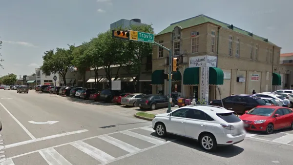
The ForwardDallas initiative is attempting for the Holy Grail of planning: development certainty.

The Dallas Development Code was written in 1965 and last updated in 1987, but the city’s Planning and Urban Design Department has been hard at work on an update—including “drafting a comprehensive future land use map, and digitizing boxes of paper records,” according to an article by April Towery for CandysDirt.com.
The future land use map overhaul, called ForwardDallas, launched in 2021 and is now under the leadership of Dallas planning director Julia Ryan, who has been at the helm of the department for about a year. The article devotes significant ink to allowing Ryan to discuss the challenges facing planning in Dallas, as well as the solutions enabled by ForwardDallas.
One of the key goals of ForwardDallas, according to the article, is reducing the city’s backlog of project approvals. Ryan says some of the city’s backlogs can be addressed with improved zoning—such as the city’s large amount of planning developments. “Having more than 1,200 [planned developments] is absurd. The more we can simplify zoning and increase what can be built by right, the better we can prevent [a permitting backlog] from happening again,” says Ryan, as quoted in the article.
FULL STORY: Dallas, We Have a Plan: Zoning Could Get Easier And Faster, Says Director of Planning and Urban Design

Dallas Exploring Parking Requirement Reform
Dallas relies on a formula introduced in 1965 to determine parking requirements for new developments, but city planners are studying how to update the city's development code for the future.

Dallas Launches New Comprehensive Plan Process—15 Years After ForwardDallas
The city of Dallas adopted the ForwardDallas plan in 2006, setting a grand ambition for a more walkable, transit-friendly city. Some of the work toward that vision will have to continue with the next comprehensive plan.

Dallas' First-Ever Strategic Mobility Plan Ties Land Use to New Transportation Ideas
The Connect Dallas Strategic Mobility Plan is open for public comment. Expect more big plans from Dallas soon—the ForwardDallas! comprehensive plan update will also kick off this year.

National Parks Layoffs Will Cause Communities to Lose Billions
Thousands of essential park workers were laid off this week, just before the busy spring break season.

Retro-silient?: America’s First “Eco-burb,” The Woodlands Turns 50
A master-planned community north of Houston offers lessons on green infrastructure and resilient design, but falls short of its founder’s lofty affordability and walkability goals.

Delivering for America Plan Will Downgrade Mail Service in at Least 49.5 Percent of Zip Codes
Republican and Democrat lawmakers criticize the plan for its disproportionate negative impact on rural communities.

Test News Post 1
This is a summary

Test News Headline 46
Test for the image on the front page.

Balancing Bombs and Butterflies: How the National Guard Protects a Rare Species
The National Guard at Fort Indiantown Gap uses GIS technology and land management strategies to balance military training with conservation efforts, ensuring the survival of the rare eastern regal fritillary butterfly.
Urban Design for Planners 1: Software Tools
This six-course series explores essential urban design concepts using open source software and equips planners with the tools they need to participate fully in the urban design process.
Planning for Universal Design
Learn the tools for implementing Universal Design in planning regulations.
EMC Planning Group, Inc.
Planetizen
Planetizen
Mpact (formerly Rail~Volution)
Great Falls Development Authority, Inc.
HUDs Office of Policy Development and Research
NYU Wagner Graduate School of Public Service