


Planners presented two options for new tunnels that would help connect more parts of the Northern California megaregion to San Francisco and Oakland.

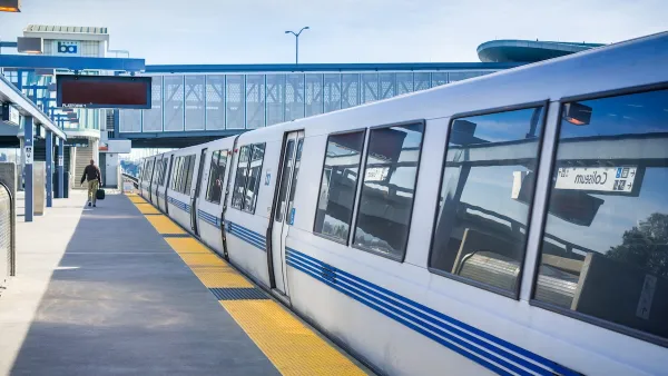
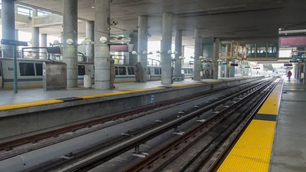
Plans for a new tunnel across the San Francisco Bay are shaping up as the public finally got a look at “the most detailed maps yet” showing the proposed tunnel’s route. As Benjamin Schneider reports for the San Francisco Examiner, planners for the Link21 project revealed two options for the tunnel. “One shows BART and regional rail trains — like Capitol Corridor or Caltrain — traveling side by side in a shared alignment from Oakland and Alameda to the Salesforce Transit Center in San Francisco.”
The second option would have two tunnels separating BART and regional trains. “Both plans hint at the possibility of a BART subway down Geary Boulevard, with the blue arrows pointing west from downtown San Francisco and labeled as a ‘possible extension.’”
Across the bay in Oakland, “Jack London Square, where the A’s are hoping to build a massive development anchored by a new ballpark, and West Oakland could become major transit hubs, hosting both BART stations and regional rail stations.”
Link21 is named for the 21 counties that could be served by new connections enabled by the project.
Schneider notes that “Link21 remains a long way from reality. Project planning and approvals are expected to last through 2027. Completion is roughly projected for 2039.”
FULL STORY: A new train tunnel across the Bay? Here are early maps

San Francisco’s BART Awarded $545 Loan for Upgraded Rail Cars
The agency plans to modernize its fleet with more efficient rail cars equipped with new safety features.
Is Pay by Distance Unfair to the Poor?
Sam Raby argues that BART’s pay by distance fair structure exacerbates transit inequities.
Federal Funding for California High-Speed Rail Under Review
USDOT says it will evaluate the funding currently committed to the construction of California’s high-speed rail project, which has run years behind schedule and billions over its projected budget.

National Parks Layoffs Will Cause Communities to Lose Billions
Thousands of essential park workers were laid off this week, just before the busy spring break season.

Retro-silient?: America’s First “Eco-burb,” The Woodlands Turns 50
A master-planned community north of Houston offers lessons on green infrastructure and resilient design, but falls short of its founder’s lofty affordability and walkability goals.

Delivering for America Plan Will Downgrade Mail Service in at Least 49.5 Percent of Zip Codes
Republican and Democrat lawmakers criticize the plan for its disproportionate negative impact on rural communities.

Test News Post 1
This is a summary

Test News Headline 46
Test for the image on the front page.

Balancing Bombs and Butterflies: How the National Guard Protects a Rare Species
The National Guard at Fort Indiantown Gap uses GIS technology and land management strategies to balance military training with conservation efforts, ensuring the survival of the rare eastern regal fritillary butterfly.
Urban Design for Planners 1: Software Tools
This six-course series explores essential urban design concepts using open source software and equips planners with the tools they need to participate fully in the urban design process.
Planning for Universal Design
Learn the tools for implementing Universal Design in planning regulations.
EMC Planning Group, Inc.
Planetizen
Planetizen
Mpact (formerly Rail~Volution)
Great Falls Development Authority, Inc.
HUDs Office of Policy Development and Research
NYU Wagner Graduate School of Public Service